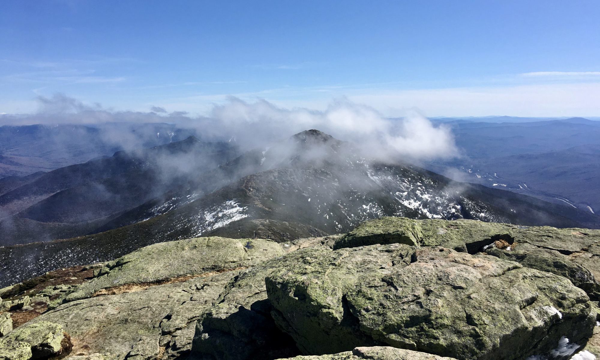
The 2026 White Mountain Environmental Field School concluded with a symposium presenting five weeks of research, monitoring and fieldwork by students, summit stewards and our International Trails Fellow. Taken together, the presentations offered more than a collection of individual projects. They provided a remarkably integrated picture of Franconia Ridge—how people move through it, where and why they leave the trail, how heavy use affects its infrastructure and what a more responsive form of stewardship might look like.
The symposium also drew together longer histories: four years of field schools, nine years of summit stewardship on Franconia Ridge and forty-six years of West End Trail Tenders experience. Its clearest conclusion was that research, education, trail design and maintenance cannot be treated as separate activities. Each must inform the others.
Introduction: A Narrow Alpine Zone Under Pressure
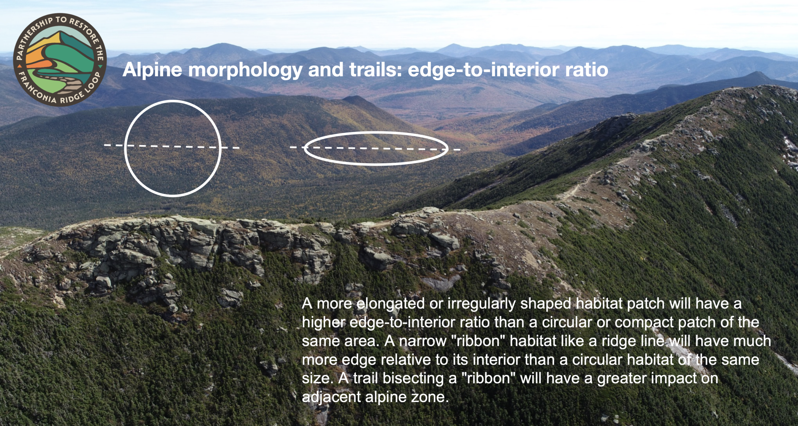
Franconia Ridge’s alpine zone is essentially a long, narrow ribbon. Because so much of it lies immediately beside the trail, even localized widening and trampling can affect a substantial portion of its fragile plant communities.
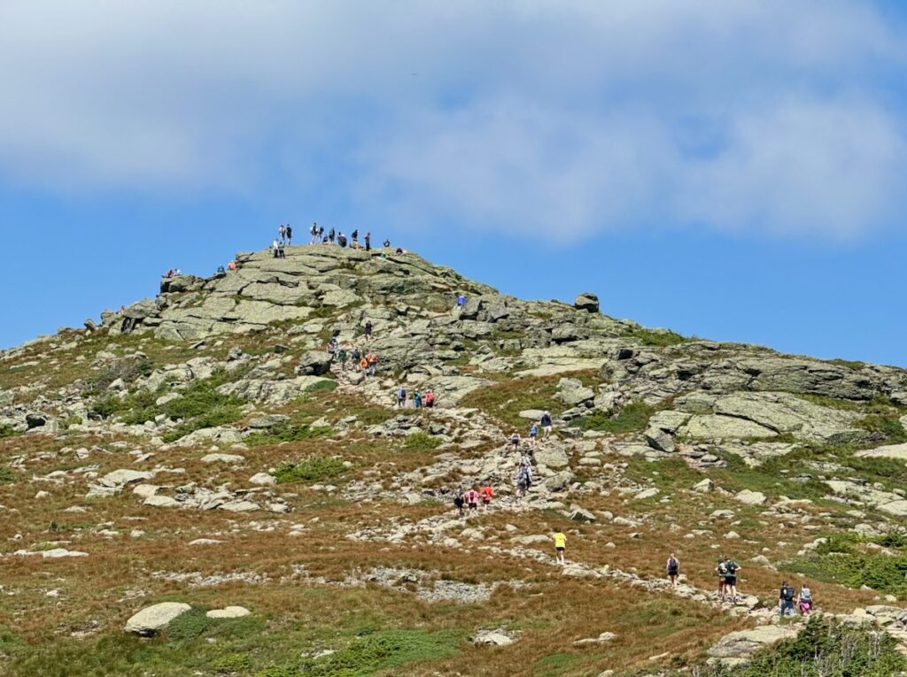
Visitor counts illustrate the scale of the challenge. Between July 2 and August 6, 2026, three days brought more than 1,000 visitors to the Ridge, with eight days recording at least 500. These numbers do not by themselves explain why people leave the trail, but they greatly multiply the consequences when they do.
Sarah Heller: Understanding Visitor Flow
Sarah Heller examined how visitor volume relates to off-trail behavior. Her hypothesis was not simply that more hikers would produce more off-trail events—an increase that would occur even if the proportion remained constant. She asked whether the rate of off-trail behavior might rise sharply once visitor flow reached a critical level. In other words, could crowding push the trail system across a threshold at which interactions among hikers, combined with the physical limitations of the trail, produce a disproportionate surge in off-trail activity?
To test this hypothesis, Sarah compared observations of off-trail behavior at four locations with electronic trail-counter data. Her results did not reveal the anticipated surge. The percentage of visitors leaving the trail varied during the observation period, but it did not rise systematically with hourly visitor volume. People went off trail during both busier and less busy periods.
This result does not disprove the threshold hypothesis. Observations were conducted during only one five-hour period on a busy Saturday, when use was already near its daily peak. The study therefore captured a relatively narrow range of generally high-use conditions. Detecting a transition from low-use to crowded conditions would require observations over entire days and across multiple days with substantially different visitor volumes.
A separate examination of 15-minute trail-counter data from another Saturday revealed additional complexity. The hourly totals show the familiar “wave” of hikers moving across the Ridge, but the finer-resolution data show smaller clusters pulsing within that larger wave. Hikers do not arrive as a steady stream. They bunch together and spread apart, somewhat like vehicles in highway traffic. A one-hour total may therefore conceal short periods of crowding at particular trail features, even when the hourly average appears moderate.
Visitor numbers are also only one part of the system. Trail width, high steps, unstable footing, unclear boundaries, direction of travel and the availability of places to pause or pass can all influence individual decisions. Hikers also respond to one another and to the choices made by those ahead of them. Taken together with Logan Tillinghast’s trail audit, Sarah’s work suggests that off-trail behavior emerges from the interaction of visitor flow, individual decisions and physical trail conditions—not from any one variable acting alone.
This helps explain why a simple comparison of off-trail events with hikers per hour may not fully represent behavior on the Ridge. Sarah proposed agent-based modeling as a possible next step. An agent-based model could simulate individual hikers moving through a representation of the trail, with different hikers responding to grade, trail width, obstacles, other visitors and opportunities to step aside. Researchers have already demonstrated the potential of using detailed visitor-tracking data to construct such models of off-trail behavior, although the method still requires careful development and validation. D’Antonio and colleagues’ proof-of-concept study
Sarah’s project therefore provides both a finding and a direction for future research. It found no simple relationship between hourly use and the percentage of hikers leaving the trail during the period studied. More importantly, it showed why future monitoring should collect finer-grained data across a wider range of conditions and examine visitor movement and trail design as parts of the same complex system.
Logan Tillinghast: Auditing the Physical Trail
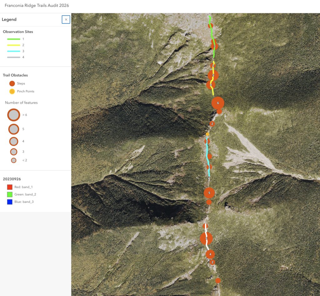
Logan Tillinghast conducted an “audit” of the Franconia Ridge Trail between Little Haystack and Lafayette, the most sensitive section of the alpine zone on the Franconia Ridge Loop. He inventoried physical trail features that students in previous years had associated with off-trail hotspots, including high steps, trail width and “pinch points” (places where the trail narrows or rocks create obstacles). He also remotely measured the grade of different trail sections.
Logan then analyzed observations made by four students at four off-trail hotspots. The differences among the sites were striking. At a relatively wide section with gentle grade, low rugosity (surface roughness), only 1.69 percent of visitors were observed leaving the trail. At the South Lincoln scramble—with an average grade of 34.4 percent, numerous high steps and unclear trail boundaries—the rate reached 24.46 percent. The other locations fell between these extremes. Altogether, students recorded more than 1,000 instances of hikers leaving the trail during a single day of observations across the four sites.
Combining his trail audit with the field notes of the other students, Logan evaluated the influence of high steps, trail width, pinch points and grade, as well as other observed reasons for leaving the trail, including unclear boundaries and the lack of places to pause, pass or allow others to pass. No single variable explained what happened at every location. Instead, off-trail behavior appeared to emerge from the interaction between visitor movement and the trail’s overall condition and design.
Taken together with Sarah Heller’s research on visitor flow, Logan’s work suggests that much of what appears to be careless behavior is related to trail design and condition. Awkward or uncomfortable trail conditions encourage hikers to improvise another route. Stewardship therefore requires more than asking visitors to remain on the trail. It requires a tread that invites them to stay within its boundaries.
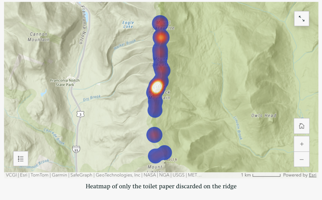
CJ Ellison: The Human-Waste Problem on Franconia Ridge
CJ Ellison examined another consequence of concentrated visitor use: human waste. Existing facilities at Greenleaf Hut and Liberty Spring help, but they do not fully serve the long, heavily traveled section of trail between them. Building on the work of Maeve Mikulski, a student from an earlier field school, CJ identified Little Haystack and Lafayette Col as particular hotspots for bathroom use. In addition to the visible toilet paper and feces, the smell of human waste can be strong at these locations on busy Saturdays.
Using a generalized formula for average human waste production, CJ estimated the amount that could be produced by 45,000 visitors May to October—the 2024 count recorded by trail counters—during the four hours it takes an average hiker to travel from the Old Bridle Path trailhead up Falling Waters Trail, across Franconia Ridge and down the Greenleaf Trail to Greenleaf Hut. The calculation produced an estimate of 240 kilograms of dry fecal matter and 13,500 liters of urine over the May-to-October hiking season.
This calculation does not measure how much human waste is actually deposited along the trail. Many hikers will not relieve themselves during this part of the hike, while others will use established facilities. Nevertheless, it provides a sense of the potential volume generated while visitors are between facilities and helps place the visual and olfactory evidence at known hotspots in context.
CJ proposed investigating the feasibility of installing a urine-diverting composting privy near the Shining Rock junction. Because urine is separated from solid waste, this type of system can require less maintenance than the batch-composting systems commonly used in the White Mountain National Forest. Those systems require regular mixing and substantial quantities of bark mulch, which must be transported to remote locations. Urine-diverting technology has already been introduced in the White Mountains, including at Liberty Spring Tentsite.
With a manageable inspection and maintenance schedule, summit stewards could potentially incorporate routine care of the facility into their duties. The Shining Rock junction already has an informational kiosk addressing visitor safety and protection of the alpine zone. Information about responsible human-waste practices could be added there as part of a broader educational effort.
Any such facility would require careful consideration of its location, cost, permitting, waste removal, visitor education and long-term maintenance. Nevertheless, as visitor use continues at its present scale, the health, environmental and visitor-experience consequences of unmanaged human waste on Franconia Ridge warrant serious attention.
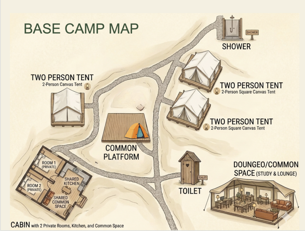
Ipsi Castillo: Base Camp as a Living Laboratory
International Trails Fellow Ipsi Castillo turned the same critical attention toward the field school’s base camp at Sandwich Mountain Farm. She conducted a broad facilities audit, examining water use, the composting privy, shower graywater, kitchen wastewater, food storage, recycling and the limitations of a crowded kitchen.
Ipsi began with a fundamental problem: we currently have little data on how much water the field school uses or where it goes. She recommended installing water meters and combining their measurements with logs and direct observation. This would allow future students to establish a baseline, identify periods of unusually high consumption and evaluate whether changes to facilities or daily practices actually reduce water use.
She also examined each wastewater stream separately. For the shower, she proposed improving the existing dry well with a wood-chip biofilter that would help filter soaps and other materials from the graywater before it enters the soil. For the composting privy, she recommended separating urine from solid waste and directing it to an appropriately designed soakaway. Like the system proposed by CJ for Franconia Ridge, urine diversion would reduce moisture in the composting chamber, support decomposition and simplify maintenance.
Kitchen wastewater presents a more difficult challenge. In New Hampshire, water from a kitchen sink is treated as blackwater because it contains grease, food particles and other organic material. Ipsi explored a system that would begin with a grease trap or settling tank and then direct the water into an appropriately designed leaching system or planted biofilter. Such a system might use moisture-tolerant native plants to help filter and absorb nutrients before the water returns to the environment. Any final design would, of course, require professional review and compliance with state and local requirements.
Her audit also considered how the physical organization of the kitchen affects communal life. Crowded work surfaces, poorly used storage space and unclear systems for dishwashing, recycling and food storage create unnecessary stress during meal preparation and cleanup. A redesigned kitchen could make these shared responsibilities safer, more efficient and easier for students to understand and manage.
The educational value of these improvements may be as important as their environmental benefits. Water meters, a shower biofilter, a urine-diverting privy and a kitchen wastewater system would all be visible, measurable systems. Students could help operate them, collect data, study their performance and recommend improvements from one field season to the next. Base camp would become more than lodging: it would become a living laboratory where students confront the practical questions behind environmental stewardship—where water comes from, where waste goes and how we determine whether a proposed solution actually works.
Mitchell Rescate and Wendy Skinner: Lessons from the Welch Ledges
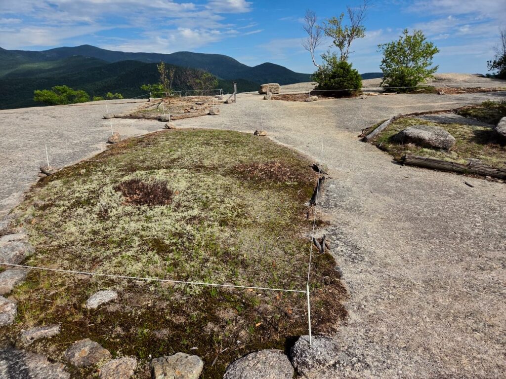
Mitchell Rescate and Wendy Skinner focused on the first open ledge on the Welch Mountain Trail, where patches—or “islands”—of fragile subalpine plants, mosses and lichens lie within a heavily used recreation area. Years of trampling had damaged these communities, while unclear routes and deteriorating log barriers made it difficult for visitors to recognize where they should walk.
Together, Mitchell and Wendy mapped the vegetation islands, damaged soil, rocks, trees, existing barriers and informal routes across the ledge. They also observed how visitors moved through and used the area and spoke informally with hikers. Their conversations revealed an important educational gap. Some frequent visitors had never paid close attention to the plants or understood their vulnerability until someone explained their significance.
Their project combined two complementary forms of visitor management. Direct management physically influences where people walk. At Welch, this meant replacing rotting log barriers with string fencing that more clearly defines the durable granite surfaces available for walking and resting while protecting recovering vegetation. Their restoration work also included assisting damaged islands by placing locally gathered organic material in bare areas to stabilize soil and encourage natural recovery.
Indirect management seeks to influence visitors through information and education. Mitchell and Wendy examined the existing signs and recommended shorter, more immediate messages placed near the areas being protected. A sign beside the fencing can connect the physical boundary with its purpose: visitors are not simply being told where they cannot go, but are being shown what the boundary protects and why their cooperation matters.
Mitchell and Wendy also emphasized that installation is only the beginning of restoration. They proposed establishing repeatable photographic monitoring, potentially using QR-code photopoints that would allow photographs to be taken from the same locations over time. This would create a visual record of whether vegetation is recovering, bare ground is shrinking and fencing remains effective. Periodic steward visits could supplement the photographs with observations, minor repairs and conversations with visitors without requiring a continuous presence.
Welch offers a manageable setting in which to test how direct management, education, restoration and monitoring can reinforce one another. Its lessons are relevant to Franconia Ridge: define where visitors can walk, explain why the boundary matters, assist damaged vegetation and continue watching after the work is installed. Restoration is not a single project but a long-term process of observation, maintenance and adjustment.
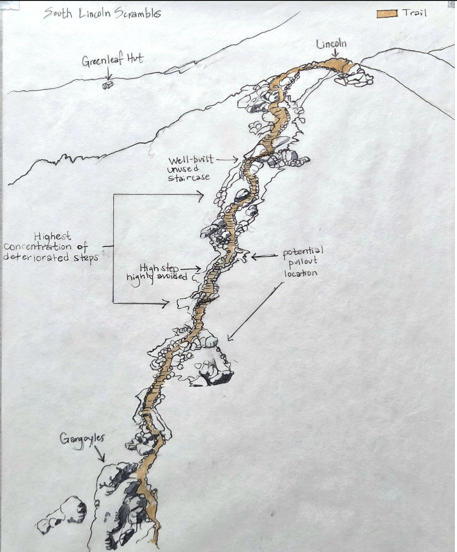
Whitney Lee: A New Paradigm for Alpine Trail Management
Summit Steward Whitney Lee brought many of the symposium’s findings together in a proposal for a new approach to Franconia Ridge trail work.
The traditional response to widening has relied heavily on scree walls. With today’s volume of hikers, however, those walls require continual rebuilding and often fail to address the reason people are stepping aside. Whitney proposed investing less time in scree walls and more in creating an “easeful tread”—a trail that naturally invites people to remain within it.
Her recommendations include using more string fencing, permitting double-track tread where appropriate, creating pullouts where visitors can rest or pass, reducing oversized steps, overlapping and properly founding stone steps and crushing loose rock into the tread and behind stonework.
She also proposed training summit stewards in more advanced stone masonry so they can spend part of each week completing focused restoration projects at priority locations. Stewards would continue their educational and monitoring roles, but trail tending would become an even more substantial part of their work.
This would represent a meaningful change in emphasis: from occasional large reconstruction projects toward continuous, skilled and adaptive care—see blog essay for more detail.
Wendy Skinner: A Return to Walking
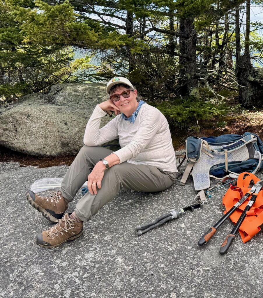
Wendy Skinner closed the symposium with an essay, “A Return to Walking” a goal she ultimately questions. Drawing on childhood walks in rural Indiana and her experiences as an octogenarian learning to climb and work on Welch Mountain, Wendy distinguishes between hiking as purposeful movement toward a destination and walking as a more contemplative way of being within a place.
As she becomes stronger and more comfortable on the mountain, she also becomes increasingly attentive to it: exposed roots, eroded stonework, mosses, lichens, tiny flowers and the dwindling islands of subalpine vegetation on the ledges. Her restoration work—and an encounter with a violent mountain storm—deepens this awareness.
Wendy’s observations also raise a significant question about trail design. The lower Welch trail follows a steep, direct route that carries water, exposes roots and encourages visitors to concentrate on getting through it. She wonders whether its very crudity teaches people to hurry and pay less attention. She imagines another kind of route: a meandering “walker’s way” that would encourage visitors to slow down and notice where they are.
Her contribution expands the meaning of stewardship. Trail design affects more than erosion and foot placement. It can influence pace, attention and the relationship visitors form with a landscape. A well-designed trail may help protect plants not only by containing feet, but by cultivating awareness.
From Individual Projects to a Shared Vision
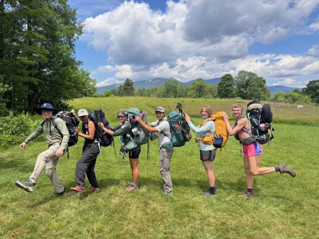
Each presentation approached stewardship from a different direction. Sarah examined visitor flow as part of a complex system shaped by individual behavior and trail conditions. Logan documented how physical trail design influences where people walk. CJ considered the infrastructure required by concentrated use. Ipsi turned the same scrutiny toward the environmental systems and communal life of base camp. Mitchell and Wendy explored how restoration, physical boundaries and education can protect fragile vegetation at Welch. Whitney brought these findings together in a practical strategy for designing and maintaining a trail that invites hikers to remain within its boundaries.
Together, their work suggests a continuous cycle:
Observe. Design. Act. Monitor. Adapt.
This is also the emerging vision for the Alpine Stewardship Center. Students and fellows can investigate questions that arise from work in the field. Summit stewards can provide a continuing presence through observation, education, maintenance and restoration. Experienced trail workers can teach advanced skills, while volunteers contribute knowledge, labor and a long-term relationship with particular places. Base camp itself can become part of the curriculum, allowing students to study, operate and improve the systems that support the program.
The symposium showed that research, education, trail work and monitoring are most valuable when they form parts of a continuing process. A study can guide an intervention; the intervention can be monitored; and what happens next can generate better questions. This approach replaces the separation between studying a problem and caring for a place with a model in which each informs the other.
Franconia Ridge, Welch Mountain and the field school’s base camp can become connected learning environments—places where stewardship is not a one-time project but a sustained practice of attention, experimentation and care. That continuing exchange among people, trails and mountain ecosystems is where the students’ individual projects become a shared program of stewardship—and where the vision of the Alpine Stewardship Center begins to take physical form.
References and Project Sources
Apollo, M. (2016). Mountaineer’s waste: Past, present and future. Annals of Valahia University of Targoviste, Geographical Series, 16(2), 13–32. https://doi.org/10.1515/avutgs-2016-0002
Cole, D. N. (2019). The relationship between amount of visitor use and environmental impacts (Contributing Paper, Edition One). Interagency Visitor Use Management Council.
Dallas, S., Scheffe, B., & Ho, G. (2004). Reedbeds for greywater treatment—Case study in Santa Elena-Monteverde, Costa Rica, Central America. Ecological Engineering, 23(1), 55–61. https://doi.org/10.1016/j.ecoleng.2004.07.002
D’Antonio, A., Monz, C. A., Crabb, B., Baggio, J. A., & Howe, P. D. (2022). Proof of concept study using GPS-based tracking data to build agent-based models of visitors’ off-trail behavior in nature-based tourism settings. Applied Geography, 147, 102771. https://doi.org/10.1016/j.apgeog.2022.102771
Greywater and Wastewater Industry Group, & Josh Byrne & Associates. (2019). The West Australian Greywater Guide: A source of practical information on how to best reuse domestic greywater in Western Australia. Water Corporation.
Hill, G. (2020, July 27). TTS operation and maintenance presentation to BC Parks [Video]. YouTube. https://www.youtube.com/watch?v=sES-NPGFMyI
Hockett, K. S., Marion, J. L., & Leung, Y.-F. (2017). The efficacy of combined educational and site management actions in reducing off-trail hiking in an urban-proximate protected area. Journal of Environmental Management, 203(Part 1), 17–28. https://doi.org/10.1016/j.jenvman.2017.06.073
Marion, J. L. (2016). A review and synthesis of recreation ecology research supporting carrying capacity and visitor use management decision making. Journal of Forestry, 114(3), 339–351. https://doi.org/10.5849/jof.15-062
Mikulski, M. (2022, July 17). Litter on Franconia Ridge. ArcGIS StoryMaps. https://storymaps.arcgis.com/stories/7f59a14e1305417380b32f71a01f5ead
Muhar, A., Arnberger, A., & Brandenburg, C. (2002). Methods for visitor monitoring in recreational and protected areas: An overview. In A. Arnberger, C. Brandenburg, & A. Muhar (Eds.), Monitoring and management of visitor flows in recreational and protected areas: Conference proceedings (pp. 1–6). Institute for Landscape Architecture and Landscape Management, Bodenkultur University.
Park, L. O., Manning, R. E., Marion, J. L., Lawson, S. R., & Jacobi, C. (2008). Managing visitor impacts in parks: A multi-method study of the effectiveness of alternative management practices. Journal of Park and Recreation Administration, 26(1), 97–121.
Park, L. O., Marion, J. L., & Wimpey, J. F. (2023). Efficacy of combining education and site management in reducing off-trail travel in a fragile biotic community, Acadia National Park. Journal of Interpretation Research, 28(1), 25–49. https://doi.org/10.1177/10925872221133774
Reigner, N., Valliere, W., Kiewra, L., Perry, E., & Manning, R. (2017). Monitoring and evaluating indicators of recreational quality on the White Mountain National Forest. Park Studies Laboratory, Rubenstein School of Environment and Natural Resources, University of Vermont.
Strongwell. (2023). Composites are flush with decomposition toilets [Case study]. https://www.strongwell.com/wp-content/uploads/2023/08/1212-Composting-Toilet.pdf
Toilet Tech Solutions. (n.d.). Behind the Wall urine-diverting conveyor toilet. https://www.toilettech.com/conveyor-toilet
Toilet Tech Solutions. (n.d.). Current product pricing. https://www.toilettech.com/product-pricing