Towards a New Paradigm for Alpine Trail Management

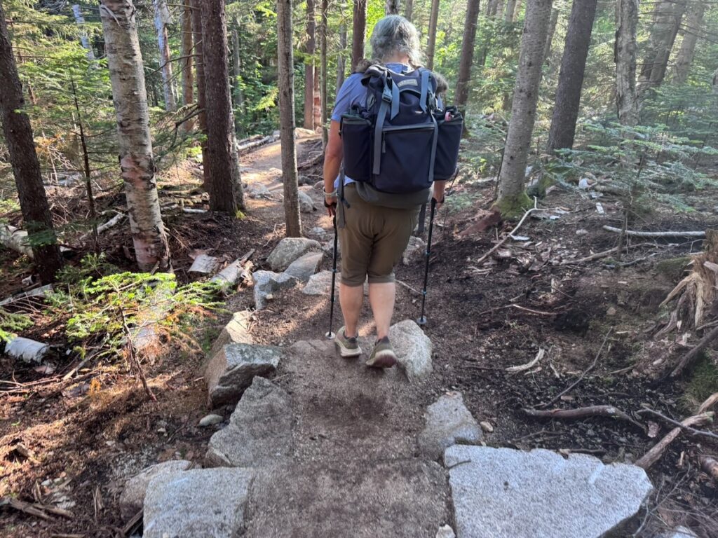
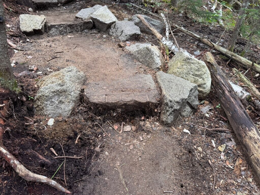
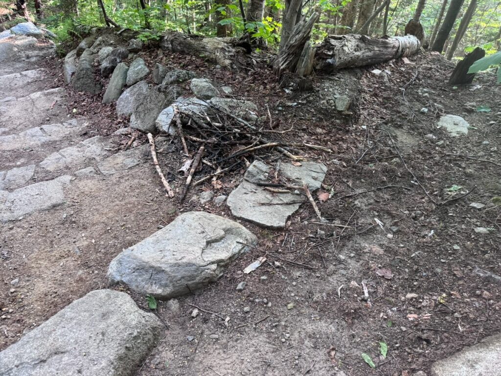
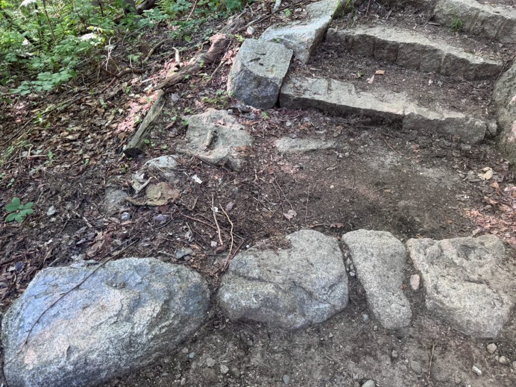
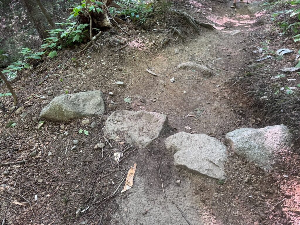
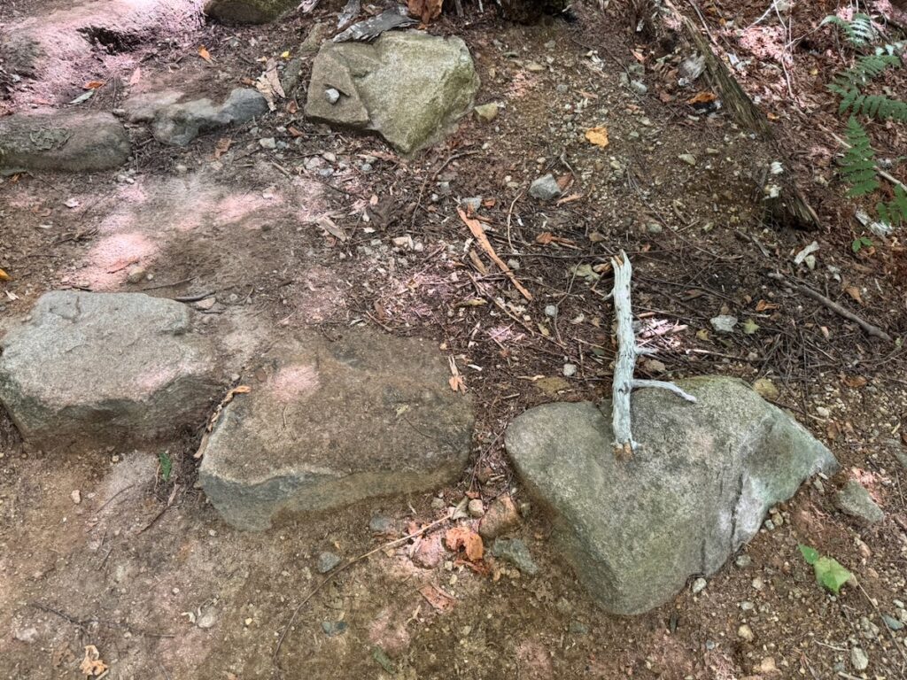
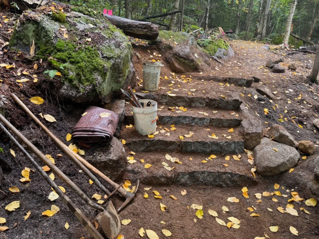
During her presentation at the WMEFS symposium, Summit Steward Whitney Lee proposed restructuring summit-steward responsibilities in a way that could, over time, restore the trails of the Franconia Ridge Loop within the alpine zone. At the heart of her proposal is training summit stewards in more advanced stone masonry so that they can spend several days each week tackling significant restoration projects at high-priority off-trail hotspots. This would replace some of the time now devoted to repeatedly rebuilding scree walls, which have become increasingly ineffective as visitor use on the Ridge has grown.

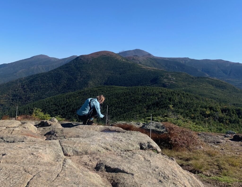
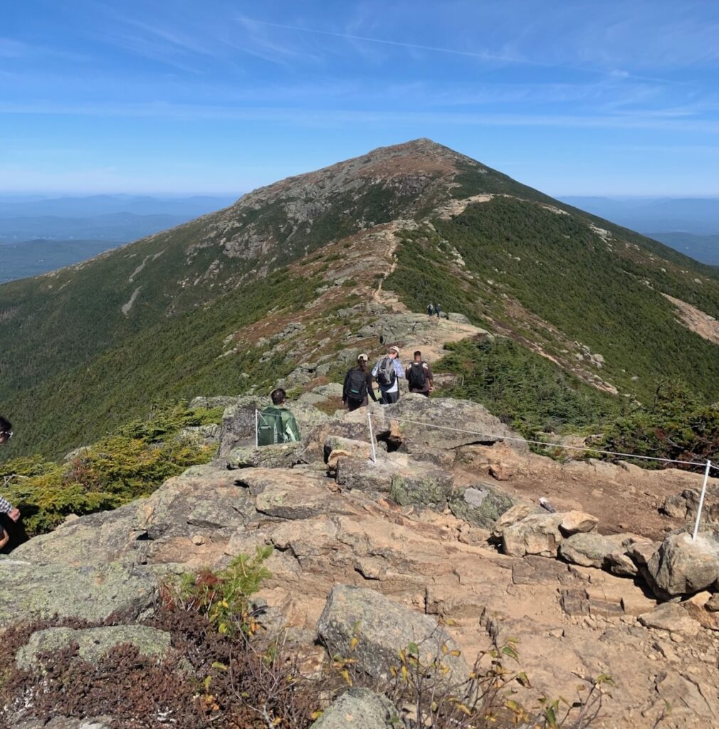
To define trail boundaries more clearly, Whitney proposed expanding the use of string fencing, which has proven highly effective. Its appearance and durability could be improved by shortening the poles and anchoring them in rocks as was done at the Welch Ledges this season.

Her trail-work recommendations include:

➔ Limit scree wall upkeep
➔ Use more string fencing
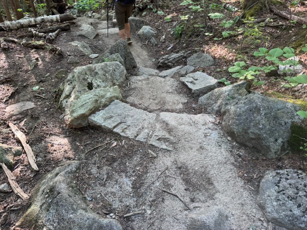
➔ Where possible, develop sections of double-lane tread between up to 60 inches wide (USFS Trail Class 3 for hiker/pedestrian)
➔  Maintain and add “pullouts” where visitors can pause, rest and let others pass
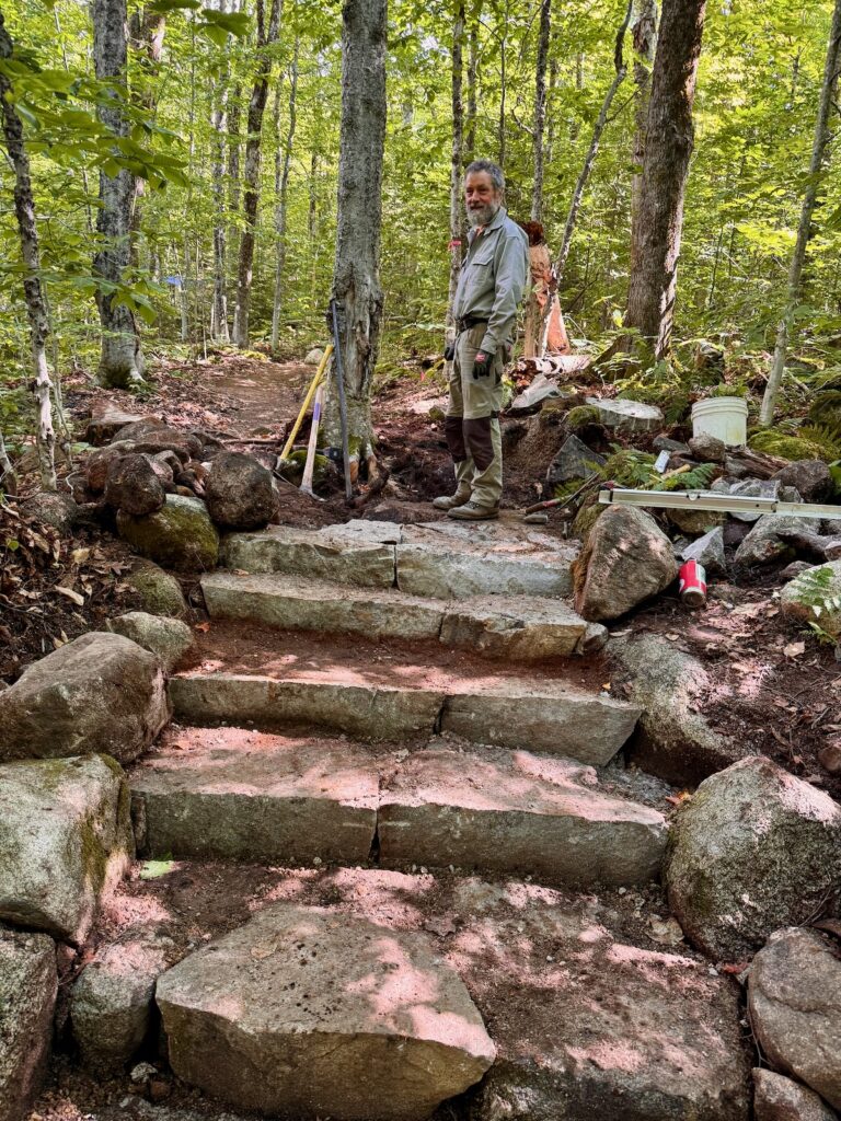
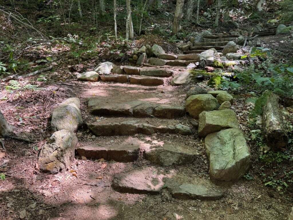
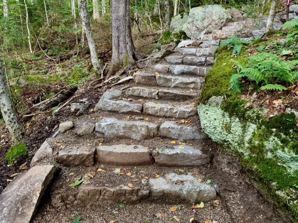
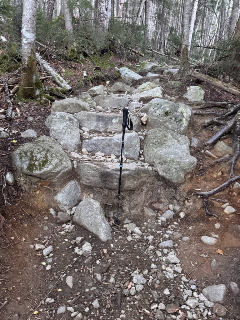
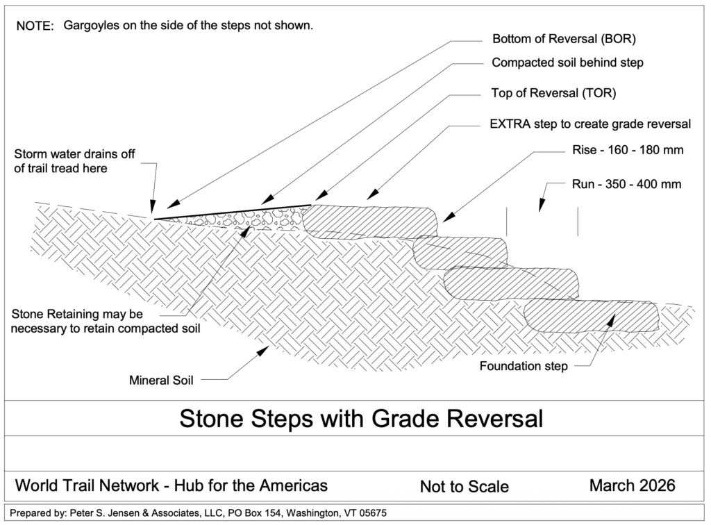
➔ Reconstruct steps that are less than 8 inches high
➔ Overlap steps
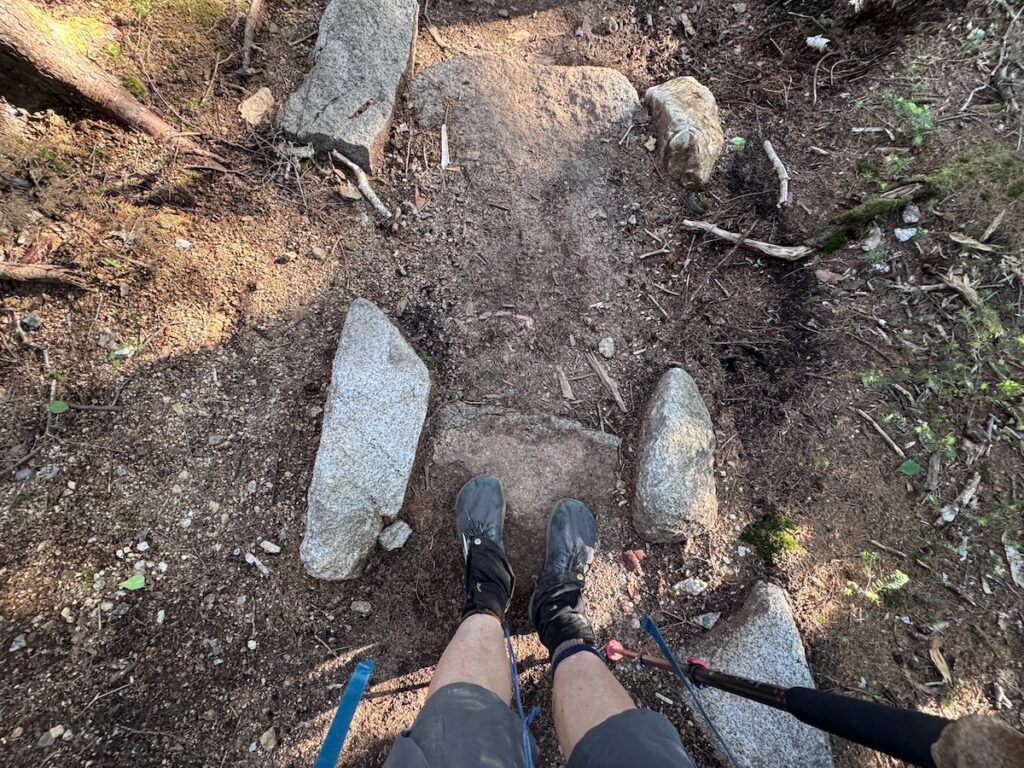
➔ Crush loose rock into tread and behind steps
➔ Place foundation rocks below steps

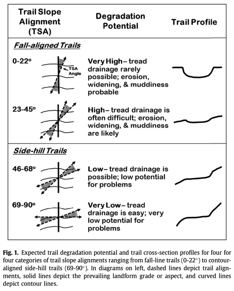
An important constraint shapes this proposal. Recreation ecologist Jeff Marion has recommended moving portions of the Franconia Ridge Trail off the ridge itself and constructing a sidehill trail as a way to reduce off-trail behavior, protect alpine vegetation, and reduce erosion. The U.S. Forest Service has taken substantial realignment off the table. That leaves us with the task of improving the tread within the existing steep, fall-line ridge alignment. If the trail cannot be realigned, it must be redesigned to function better where it is.

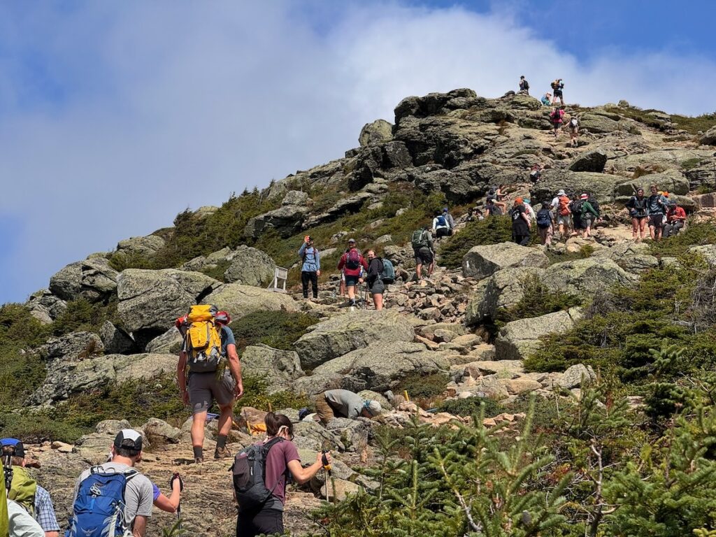
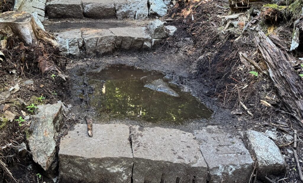
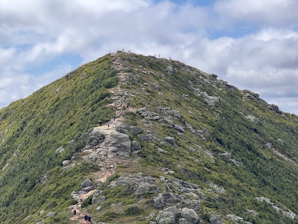
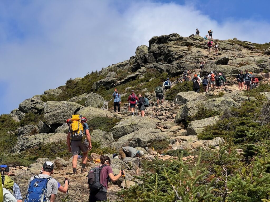
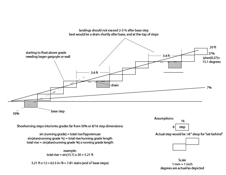
Whitney used the South Lincoln Scrambles as a “microcosm and experimental blueprint” for this approach. Logan Tillinghast’s audit found that this section has an average grade of 34.4 percent, numerous high steps and unclear trail boundaries. It also had the highest observed rate of off-trail behavior: 24.46 percent. Whitney’s drawing translates those findings into a possible redesign. Rather than trying to funnel hikers through a narrow, deteriorating staircase, the proposed tread would provide lower, overlapping steps; foundation stones and break joints for structural stability; crushed rock packed into the tread; and double-lane tread where conditions warrant. A pullout could give hikers a place to pause or allow others to pass without stepping into vegetation.

The South Lincoln project could be completed in stages and monitored as an experiment. Students could document existing conditions and visitor behavior; trained summit stewards could construct specific improvements; and future field schools could evaluate whether the redesigned tread reduces off-trail travel. The results could then guide work at other hotspots along the Ridge.

These recommendations amount to more than a collection of trail-building techniques. They represent a shift from relying primarily on large, episodic reconstruction projects toward continuous, adaptive stewardship. The field school can identify and study problems; summit stewards can provide the sustained presence needed to educate visitors, complete skilled repairs and monitor the results; and experienced trail tenders can contribute practical knowledge accumulated over decades. Research would guide restoration, restoration would generate new observations, and the work could be adjusted as trail conditions and visitor behavior change. The emerging Alpine Stewardship Center would provide an institutional home for this approach—connecting research, education, trail construction, routine maintenance and long-term monitoring in a single program capable of caring for Franconia Ridge over time.

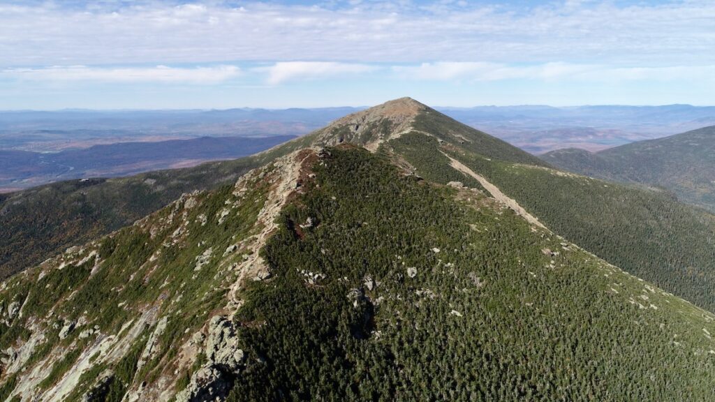
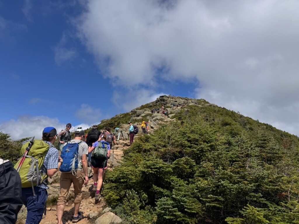
The Lincoln Scrambles South, photo by drone photo Dane Johnson.

2026 WMEFS Symposium

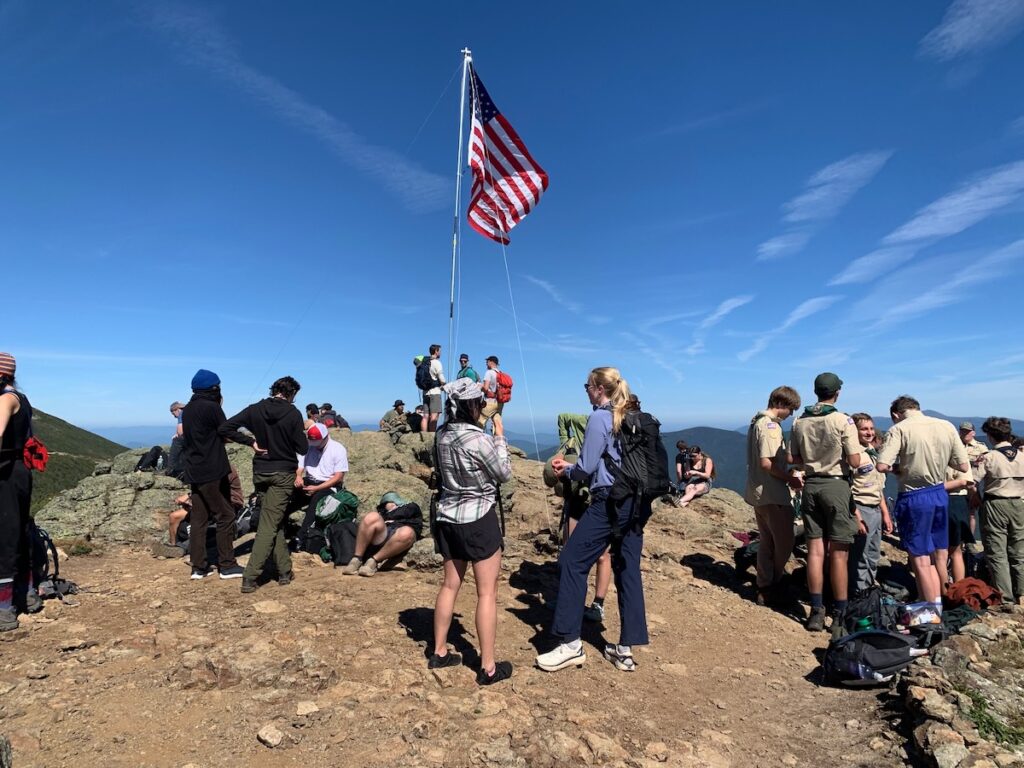
The 2026 White Mountain Environmental Field School concluded with a symposium presenting five weeks of research, monitoring and fieldwork by students, summit stewards and our International Trails Fellow. Taken together, the presentations offered more than a collection of individual projects. They provided a remarkably integrated picture of Franconia Ridge—how people move through it, where and why they leave the trail, how heavy use affects its infrastructure and what a more responsive form of stewardship might look like.

The symposium also drew together longer histories: four years of field schools, nine years of summit stewardship on Franconia Ridge and forty-six years of West End Trail Tenders experience. Its clearest conclusion was that research, education, trail design and maintenance cannot be treated as separate activities. Each must inform the others.

Introduction: A Narrow Alpine Zone Under Pressure

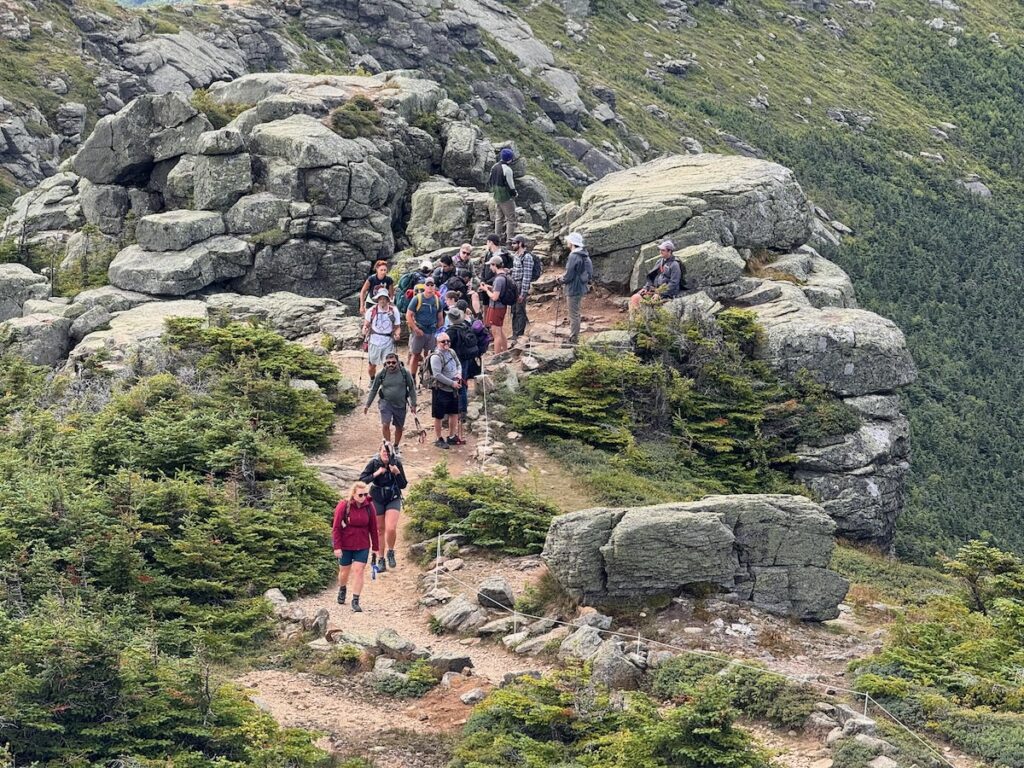
Franconia Ridge’s alpine zone is essentially a long, narrow ribbon. Because so much of it lies immediately beside the trail, even localized widening and trampling can affect a substantial portion of its fragile plant communities.

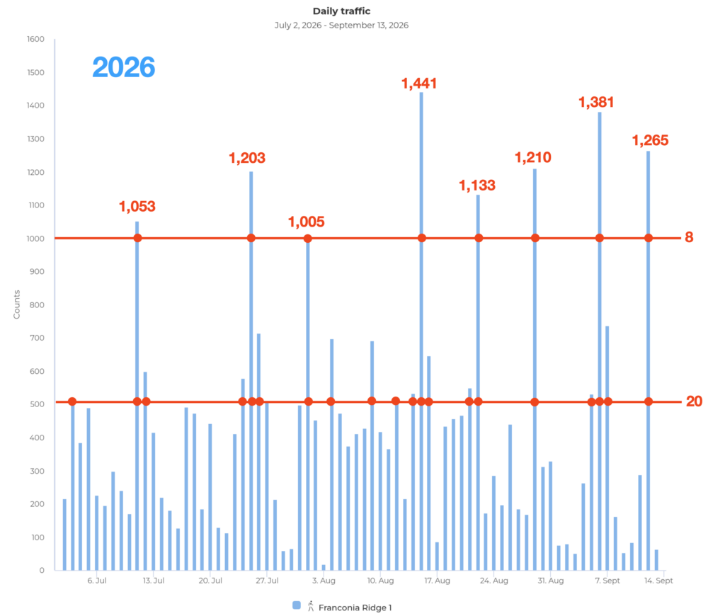
Visitor counts illustrate the scale of the challenge. Between July 2 and August 6, 2026, three days brought more than 1,000 visitors to the Ridge, with eight days recording at least 500. These numbers do not by themselves explain why people leave the trail, but they greatly multiply the consequences when they do. 

Sarah Heller: Understanding Visitor Flow

Sarah Heller examined how visitor volume relates to off-trail behavior. Her hypothesis was not simply that more hikers would produce more off-trail events—an increase that would occur even if the proportion remained constant. She asked whether the rate of off-trail behavior might rise sharply once visitor flow reached a critical level. In other words, could crowding push the trail system across a threshold at which interactions among hikers, combined with the physical limitations of the trail, produce a disproportionate surge in off-trail activity?

To test this hypothesis, Sarah compared observations of off-trail behavior at four locations with electronic trail-counter data. Her results did not reveal the anticipated surge. The percentage of visitors leaving the trail varied during the observation period, but it did not rise systematically with hourly visitor volume. People went off trail during both busier and less busy periods. 

This result does not disprove the threshold hypothesis. Observations were conducted during only one five-hour period on a busy Saturday, when use was already near its daily peak. The study therefore captured a relatively narrow range of generally high-use conditions. Detecting a transition from low-use to crowded conditions would require observations over entire days and across multiple days with substantially different visitor volumes.

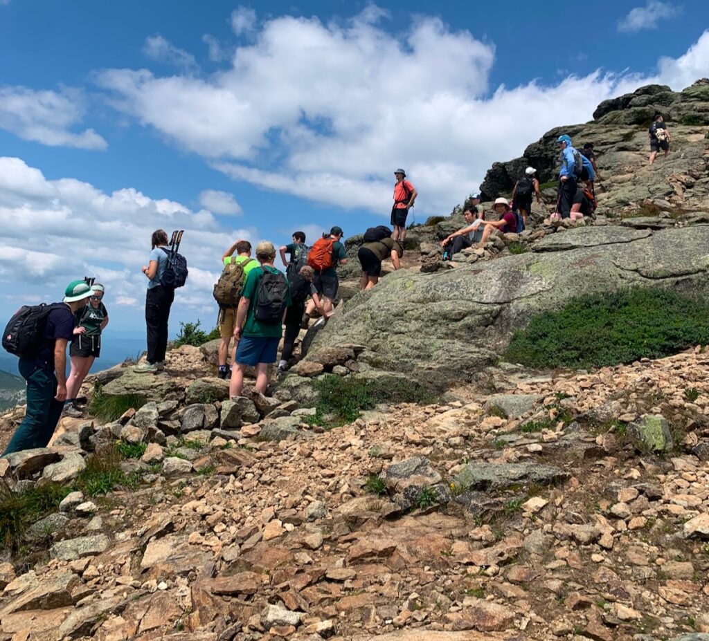
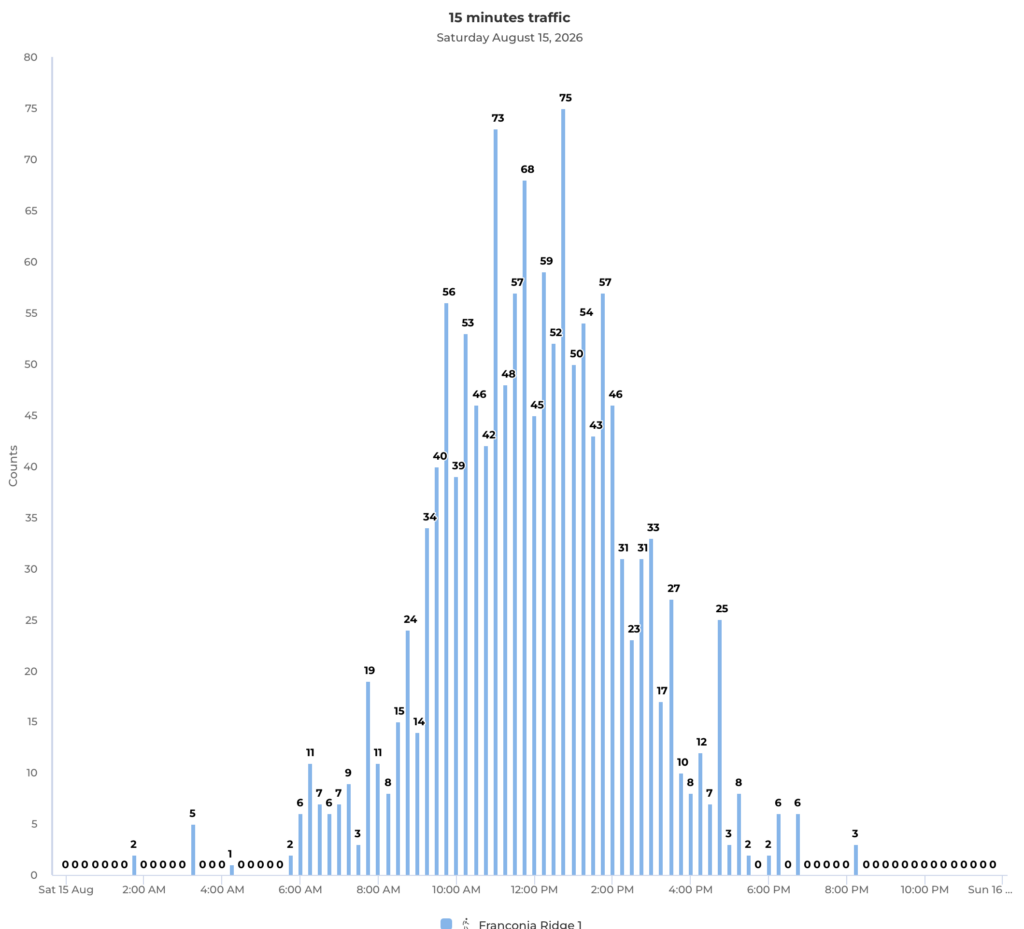
A separate examination of 15-minute trail-counter data from another Saturday revealed additional complexity. The hourly totals show the familiar “wave” of hikers moving across the Ridge, but the finer-resolution data show smaller clusters pulsing within that larger wave. Hikers do not arrive as a steady stream. They bunch together and spread apart, somewhat like vehicles in highway traffic. A one-hour total may therefore conceal short periods of crowding at particular trail features, even when the hourly average appears moderate.

Visitor numbers are also only one part of the system. Trail width, high steps, unstable footing, unclear boundaries, direction of travel and the availability of places to pause or pass can all influence individual decisions. Hikers also respond to one another and to the choices made by those ahead of them. Taken together with Logan Tillinghast’s trail audit, Sarah’s work suggests that off-trail behavior emerges from the interaction of visitor flow, individual decisions and physical trail conditions—not from any one variable acting alone.

This helps explain why a simple comparison of off-trail events with hikers per hour may not fully represent behavior on the Ridge. Sarah proposed agent-based modeling as a possible next step. An agent-based model could simulate individual hikers moving through a representation of the trail, with different hikers responding to grade, trail width, obstacles, other visitors and opportunities to step aside. Researchers have already demonstrated the potential of using detailed visitor-tracking data to construct such models of off-trail behavior, although the method still requires careful development and validation. D’Antonio and colleagues’ proof-of-concept study

Sarah’s project therefore provides both a finding and a direction for future research. It found no simple relationship between hourly use and the percentage of hikers leaving the trail during the period studied. More importantly, it showed why future monitoring should collect finer-grained data across a wider range of conditions and examine visitor movement and trail design as parts of the same complex system.

Logan Tillinghast: Auditing the Physical Trail

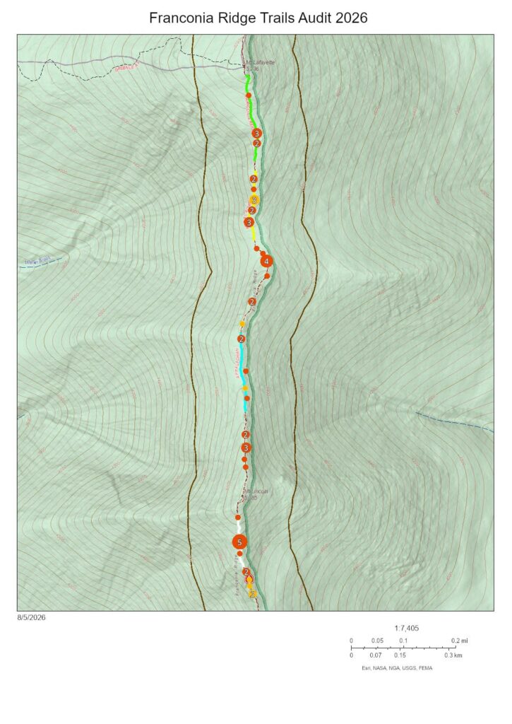
Logan Tillinghast conducted an “audit” of the Franconia Ridge Trail between Little Haystack and Lafayette, the most sensitive section of the alpine zone on the Franconia Ridge Loop. He inventoried physical trail features that students in previous years had associated with off-trail hotspots, including high steps, trail width and “pinch points” (places where the trail narrows or rocks create obstacles). He also remotely measured the grade of different trail sections.

Logan then analyzed observations made by four students at four off-trail hotspots. The differences among the sites were striking. At a relatively wide section with gentle grade, low rugosity (surface roughness), only 1.69 percent of visitors were observed leaving the trail. At the South Lincoln scramble—with an average grade of 34.4 percent, numerous high steps and unclear trail boundaries—the rate reached 24.46 percent. The other locations fell between these extremes. Altogether, students recorded more than 1,000 instances of hikers leaving the trail during a single day of observations across the four sites.

Combining his trail audit with the field notes of the other students, Logan evaluated the influence of high steps, trail width, pinch points and grade, as well as other observed reasons for leaving the trail, including unclear boundaries and the lack of places to pause, pass or allow others to pass. No single variable explained what happened at every location. Instead, off-trail behavior appeared to emerge from the interaction between visitor movement and the trail’s overall condition and design.

Taken together with Sarah Heller’s research on visitor flow, Logan’s work suggests that much of what appears to be careless behavior is related to trail design and condition. Awkward or uncomfortable trail conditions encourage hikers to improvise another route. Stewardship therefore requires more than asking visitors to remain on the trail. It requires a tread that invites them to stay within its boundaries.

CJ Ellison: The Human-Waste Problem on Franconia Ridge

CJ Ellison examined another consequence of concentrated visitor use: human waste. Existing facilities at Greenleaf Hut and Liberty Spring help, but they do not fully serve the long, heavily traveled section of trail between them. Building on the work of Maeve Mikulski, a student from an earlier field school, CJ identified Little Haystack and Lafayette Col as particular hotspots for bathroom use. In addition to the visible toilet paper and feces, the smell of human waste can be strong at these locations on busy Saturdays.

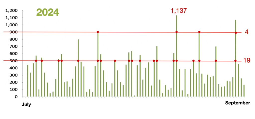
Using a generalized formula for average human waste production, CJ estimated the amount that could be produced by 45,000 visitors May to October—the 2024 count recorded by trail counters—during the four hours it takes an average hiker to travel from the Old Bridle Path trailhead up Falling Waters Trail, across Franconia Ridge and down the Greenleaf Trail to Greenleaf Hut. The calculation produced an estimate of 240 kilograms of dry fecal matter and 13,500 liters of urine over the May-to-October hiking season.

This calculation does not measure how much human waste is actually deposited along the trail. Many hikers will not relieve themselves during this part of the hike, while others will use established facilities. Nevertheless, it provides a sense of the potential volume generated while visitors are between facilities and helps place the visual and olfactory evidence at known hotspots in context.

CJ proposed investigating the feasibility of installing a urine-diverting composting privy near the Shining Rock junction. Because urine is separated from solid waste, this type of system can require less maintenance than the batch-composting systems commonly used in the White Mountain National Forest. Those systems require regular mixing and substantial quantities of bark mulch, which must be transported to remote locations. Urine-diverting technology has already been introduced in the White Mountains, including at Liberty Spring Tentsite.

With a manageable inspection and maintenance schedule, summit stewards could potentially incorporate routine care of the facility into their duties. The Shining Rock junction already has an informational kiosk addressing visitor safety and protection of the alpine zone. Information about responsible human-waste practices could be added there as part of a broader educational effort.

Any such facility would require careful consideration of its location, cost, permitting, waste removal, visitor education and long-term maintenance. Nevertheless, as visitor use continues at its present scale, the health, environmental and visitor-experience consequences of unmanaged human waste on Franconia Ridge warrant serious attention.

Ipsi Castillo: Base Camp as a Living Laboratory

International Trails Fellow Ipsi Castillo turned the same critical attention toward the field school’s base camp at Sandwich Mountain Farm. She conducted a broad facilities audit, examining water use, the composting privy, shower graywater, kitchen wastewater, food storage, recycling and the limitations of a crowded kitchen.

Ipsi began with a fundamental problem: we currently have little data on how much water the field school uses or where it goes. She recommended installing water meters and combining their measurements with logs and direct observation. This would allow future students to establish a baseline, identify periods of unusually high consumption and evaluate whether changes to facilities or daily practices actually reduce water use.

She also examined each wastewater stream separately. For the shower, she proposed improving the existing dry well with a wood-chip biofilter that would help filter soaps and other materials from the graywater before it enters the soil. For the composting privy, she recommended separating urine from solid waste and directing it to an appropriately designed soakaway. Like the system proposed by CJ for Franconia Ridge, urine diversion would reduce moisture in the composting chamber, support decomposition and simplify maintenance.

Kitchen wastewater presents a more difficult challenge. In New Hampshire, water from a kitchen sink is treated as blackwater because it contains grease, food particles and other organic material. Ipsi explored a system that would begin with a grease trap or settling tank and then direct the water into an appropriately designed leaching system or planted biofilter. Such a system might use moisture-tolerant native plants to help filter and absorb nutrients before the water returns to the environment. Any final design would, of course, require professional review and compliance with state and local requirements.

Her audit also considered how the physical organization of the kitchen affects communal life. Crowded work surfaces, poorly used storage space and unclear systems for dishwashing, recycling and food storage create unnecessary stress during meal preparation and cleanup. A redesigned kitchen could make these shared responsibilities safer, more efficient and easier for students to understand and manage.

The educational value of these improvements may be as important as their environmental benefits. Water meters, a shower biofilter, a urine-diverting privy and a kitchen wastewater system would all be visible, measurable systems. Students could help operate them, collect data, study their performance and recommend improvements from one field season to the next. Base camp would become more than lodging: it would become a living laboratory where students confront the practical questions behind environmental stewardship—where water comes from, where waste goes and how we determine whether a proposed solution actually works.

Mitchell Rescate and Wendy Skinner: Lessons from the Welch Ledges

Mitchell Rescate and Wendy Skinner focused on the first open ledge on the Welch Mountain Trail, where patches—or “islands”—of fragile subalpine plants, mosses and lichens lie within a heavily used recreation area. Years of trampling had damaged these communities, while unclear routes and deteriorating log barriers made it difficult for visitors to recognize where they should walk.

Together, Mitchell and Wendy mapped the vegetation islands, damaged soil, rocks, trees, existing barriers and informal routes across the ledge. They also observed how visitors moved through and used the area and spoke informally with hikers. Their conversations revealed an important educational gap. Some frequent visitors had never paid close attention to the plants or understood their vulnerability until someone explained their significance.

Their project combined two complementary forms of visitor management. Direct management physically influences where people walk. At Welch, this meant replacing rotting log barriers with string fencing that more clearly defines the durable granite surfaces available for walking and resting while protecting recovering vegetation. Their restoration work also included assisting damaged islands by placing locally gathered organic material in bare areas to stabilize soil and encourage natural recovery.

Indirect management seeks to influence visitors through information and education. Mitchell and Wendy examined the existing signs and recommended shorter, more immediate messages placed near the areas being protected. A sign beside the fencing can connect the physical boundary with its purpose: visitors are not simply being told where they cannot go, but are being shown what the boundary protects and why their cooperation matters.

Mitchell and Wendy also emphasized that installation is only the beginning of restoration. They proposed establishing repeatable photographic monitoring, potentially using QR-code photopoints that would allow photographs to be taken from the same locations over time. This would create a visual record of whether vegetation is recovering, bare ground is shrinking and fencing remains effective. Periodic steward visits could supplement the photographs with observations, minor repairs and conversations with visitors without requiring a continuous presence.

Welch offers a manageable setting in which to test how direct management, education, restoration and monitoring can reinforce one another. Its lessons are relevant to Franconia Ridge: define where visitors can walk, explain why the boundary matters, assist damaged vegetation and continue watching after the work is installed. Restoration is not a single project but a long-term process of observation, maintenance and adjustment.

Whitney Lee: A New Paradigm for Alpine Trail Management

Summit Steward Whitney Lee brought many of the symposium’s findings together in a proposal for a new approach to Franconia Ridge trail work.

The traditional response to widening has relied heavily on scree walls. With today’s volume of hikers, however, those walls require continual rebuilding and often fail to address the reason people are stepping aside. Whitney proposed investing less time in scree walls and more in creating an “easeful tread”—a trail that naturally invites people to remain within it.

Her recommendations include using more string fencing, permitting double-track tread where appropriate, creating pullouts where visitors can rest or pass, reducing oversized steps, overlapping and properly founding stone steps and crushing loose rock into the tread and behind stonework.

She also proposed training summit stewards in more advanced stone masonry so they can spend part of each week completing focused restoration projects at priority locations. Stewards would continue their educational and monitoring roles, but trail tending would become an even more substantial part of their work. 

This would represent a meaningful change in emphasis: from occasional large reconstruction projects toward continuous, skilled and adaptive care—see the next Raven article for more detail.

Wendy Skinner: From Hiking Back to Walking

Wendy Skinner closed the symposium with an essay, “Becoming a Hiker,” a goal she ultimately questions. Drawing on childhood walks in rural Indiana and her experiences as an octogenarian learning to climb and work on Welch Mountain, Wendy distinguishes between hiking as purposeful movement toward a destination and walking as a more contemplative way of being within a place.

As she becomes stronger and more comfortable on the mountain, she also becomes increasingly attentive to it: exposed roots, eroded stonework, mosses, lichens, tiny flowers and the dwindling islands of subalpine vegetation on the ledges. Her restoration work—and an encounter with a violent mountain storm—deepens this awareness.

Wendy’s observations also raise a significant question about trail design. The lower Welch trail follows a steep, direct route that carries water, exposes roots and encourages visitors to concentrate on getting through it. She wonders whether its very crudity teaches people to hurry and pay less attention. She imagines another kind of route: a meandering “walker’s way” that would encourage visitors to slow down and notice where they are.

Her contribution expands the meaning of stewardship. Trail design affects more than erosion and foot placement. It can influence pace, attention and the relationship visitors form with a landscape. A well-designed trail may help protect plants not only by containing feet, but by cultivating awareness.

From Individual Projects to a Shared Vision

Each presentation approached stewardship from a different direction. Sarah examined visitor flow as part of a complex system shaped by individual behavior and trail conditions. Logan documented how physical trail design influences where people walk. CJ considered the infrastructure required by concentrated use. Ipsi turned the same scrutiny toward the environmental systems and communal life of base camp. Mitchell and Wendy explored how restoration, physical boundaries and education can protect fragile vegetation at Welch. Whitney brought these findings together in a practical strategy for designing and maintaining a trail that invites hikers to remain within its boundaries.

Together, their work suggests a continuous cycle:

Observe. Design. Act. Monitor. Adapt.

This is also the emerging vision for the Alpine Stewardship Center. Students and fellows can investigate questions that arise from work in the field. Summit stewards can provide a continuing presence through observation, education, maintenance and restoration. Experienced trail workers can teach advanced skills, while volunteers contribute knowledge, labor and a long-term relationship with particular places. Base camp itself can become part of the curriculum, allowing students to study, operate and improve the systems that support the program.

The symposium showed that research, education, trail work and monitoring are most valuable when they form parts of a continuing process. A study can guide an intervention; the intervention can be monitored; and what happens next can generate better questions. This approach replaces the separation between studying a problem and caring for a place with a model in which each informs the other.

Franconia Ridge, Welch Mountain and the field school’s base camp can become connected learning environments—places where stewardship is not a one-time project but a sustained practice of attention, experimentation and care. That continuing exchange among people, trails and mountain ecosystems is where the students’ individual projects become a shared program of stewardship—and where the vision of the Alpine Stewardship Center begins to take physical form.

References and Project Sources

Apollo, M. (2016). Mountaineer’s waste: Past, present and future. Annals of Valahia University of Targoviste, Geographical Series, 16(2), 13–32. https://doi.org/10.1515/avutgs-2016-0002

Cole, D. N. (2019). The relationship between amount of visitor use and environmental impacts (Contributing Paper, Edition One). Interagency Visitor Use Management Council.

Dallas, S., Scheffe, B., & Ho, G. (2004). Reedbeds for greywater treatment—Case study in Santa Elena-Monteverde, Costa Rica, Central America. Ecological Engineering, 23(1), 55–61. https://doi.org/10.1016/j.ecoleng.2004.07.002

D’Antonio, A., Monz, C. A., Crabb, B., Baggio, J. A., & Howe, P. D. (2022). Proof of concept study using GPS-based tracking data to build agent-based models of visitors’ off-trail behavior in nature-based tourism settings. Applied Geography, 147, 102771. https://doi.org/10.1016/j.apgeog.2022.102771

Greywater and Wastewater Industry Group, & Josh Byrne & Associates. (2019). The West Australian Greywater Guide: A source of practical information on how to best reuse domestic greywater in Western Australia. Water Corporation.

Hill, G. (2020, July 27). TTS operation and maintenance presentation to BC Parks [Video]. YouTube. https://www.youtube.com/watch?v=sES-NPGFMyI

Hockett, K. S., Marion, J. L., & Leung, Y.-F. (2017). The efficacy of combined educational and site management actions in reducing off-trail hiking in an urban-proximate protected area. Journal of Environmental Management, 203(Part 1), 17–28. https://doi.org/10.1016/j.jenvman.2017.06.073

Marion, J. L. (2016). A review and synthesis of recreation ecology research supporting carrying capacity and visitor use management decision making. Journal of Forestry, 114(3), 339–351. https://doi.org/10.5849/jof.15-062

Mikulski, M. (2022, July 17). Litter on Franconia Ridge. ArcGIS StoryMaps. https://storymaps.arcgis.com/stories/7f59a14e1305417380b32f71a01f5ead

Muhar, A., Arnberger, A., & Brandenburg, C. (2002). Methods for visitor monitoring in recreational and protected areas: An overview. In A. Arnberger, C. Brandenburg, & A. Muhar (Eds.), Monitoring and management of visitor flows in recreational and protected areas: Conference proceedings (pp. 1–6). Institute for Landscape Architecture and Landscape Management, Bodenkultur University.

Park, L. O., Manning, R. E., Marion, J. L., Lawson, S. R., & Jacobi, C. (2008). Managing visitor impacts in parks: A multi-method study of the effectiveness of alternative management practices. Journal of Park and Recreation Administration, 26(1), 97–121.

Park, L. O., Marion, J. L., & Wimpey, J. F. (2023). Efficacy of combining education and site management in reducing off-trail travel in a fragile biotic community, Acadia National Park. Journal of Interpretation Research, 28(1), 25–49. https://doi.org/10.1177/10925872221133774

Reigner, N., Valliere, W., Kiewra, L., Perry, E., & Manning, R. (2017). Monitoring and evaluating indicators of recreational quality on the White Mountain National Forest. Park Studies Laboratory, Rubenstein School of Environment and Natural Resources, University of Vermont.

Strongwell. (2023). Composites are flush with decomposition toilets [Case study]. https://www.strongwell.com/wp-content/uploads/2023/08/1212-Composting-Toilet.pdf

Toilet Tech Solutions. (n.d.). Behind the Wall urine-diverting conveyor toilethttps://www.toilettech.com/conveyor-toilet

Toilet Tech Solutions. (n.d.). Current product pricinghttps://www.toilettech.com/product-pricing

Project Documentation

Welch Ledges project photographs and documentation [Google Drive folder]. https://drive.google.com/drive/folders/1UrixGOX8PqIfPxeh-FW8cY657AklJ86R

A Return to Walking

Wendy Skinner

The word “walk” originated from the Old English “walken” which stems from a Germanic term for rolling something about. At the beginning of the 13th century, it began to be used to describe the rolling gait of traveling on foot. The word “hike” is much younger. It dates from a mid-18th century East Anglian dialect, and originally was a pejorative term for “begone, go away.” It had another meaning, of pulling or jerking something up, as in hiking prices or hiking up your pants. Only about a hundred years ago did the word “hike” come into common parlance as a long, vigorous perambulation. 

Where I grew up in rural Indiana, walking was both a necessity and a pleasure. My mother and I often walked an hour on a dirt road to hail the bus that took us into town. On weekends when my father was home, he would drive through farm country scouting for what he called “a pretty place” for us to walk. 

As a young man, my father had twice travelled on foot from middle Indiana to southern Michigan to work in the apple orchards. Where there was no road, he had followed paths worn through fields and forests by itinerant workers of the 1930s. I think this developed in him an eye for trail-making, and he would stride ahead of my mother and me as he deftly bushwhacked through a pretty place on someone’s remote property. With little concern for trespass, we ventured into the midwestern woods and hillsides in all weathers. We didn’t call this hiking. We called it walking.


On a hot day in July, I have my first go at the well-used trail that leads up New Hampshire’s Welch Mountain. I navigate over and around boulders, teeter uncomfortably on exposed tree roots as bare as a dead animal’s stripped skeleton, and climb the ruins of stone staircases long since settled into history. I have boots and hiking poles; my day pack holds a snack and water laced with electrolytes. But I am not a hiker. I’m an octogenarian scribe, out of my element as I struggle in the wake of a legendary trail tender and a young man who skips over the rocky trail as if he were enjoying parkour. Sweating and panting, I follow behind, carefully planting each step and standing aside as hiker after hiker slips around me.

For about half the way, we are within sight and sound of a rocky creek, the clear water coursing over a bed of gravel and stones. The creek sings to the old trail which stolidly tolerates the thousands of footfalls that compact its already hard earth. I apologize to it, and to the trees whose naked roots suffer my weight, to the dislodged mats of moss and the kicked-over mushrooms.

Midday has slumped into afternoon by the time we reach our destination, the Welch Ledges, a bright expanse of scoured granite with scattered patches of sub-alpine lifeforms the colors of ball gowns. I marvel at the fine-grained mosses in velvety layers of chartreuse and ocher clinging to the bases of rocks while above, tiny forests of bright green are capped by airy clusters of lichen, some silvery-gray, some a shade of bleached teal as seen on the sea floor. Clusters of five-petalled blooms balance on stems as slender as button thread. 

These are the “islands” of the Ledges, individual, exquisite, and dwindling communities of organisms that can survive the harshest weather nature can whip up, but whose greatest enemy is the human foot. One misplaced footstep can wipe out a lifeform that has grown here for decades or more. I’m here as a novice trail steward, assigned to learn about and protect these fragile islands from further tramplings.


I have cut the time of my uphill climb in half. This late afternoon, I get into a rhythm, each step on the downbeat. I swing along, thinking this must be what it’s like to be a true hiker. It’s dusk when I arrive at the Ledges. I walk around the islands to the 180-degree view of the Sandwich Mountains and beyond. A solitary hiker is sitting on the ancient granite gazing at the peaks and valley. She glances at me with a smile of greeting. I sit down a few yards away, and we watch in silent camaraderie as the slanting light defines the slopes across the valley in changing shades of blue, and I wonder if this is what it means to be a true hiker.


My stewardship studies do not require me to clamber up the mountain as often as I do, but I don’t know how else to understand it. When an evening rainstorm is expected, I pack a rain jacket, water, food; get to the trailhead around 3 pm and cross paths with the last person I see on the mountain today. 

Part of my work is to create mulch to encourage growth in the bare spots of the islands. We can’t drag it up from below. It has to originate from this environment. I scrape dirt from a muddy section of the trail, crush rotting logs into wood chips, and scatter this concoction onto the islands closest to the look-out. It’s 60 paces from the muddy trail to the biggest bare patch, and 60 paces back. 60 paces from; 60 paces back. For two uneventful hours, I follow this routine, all while keeping a watch on the sky. 

White walls of rain are pouring down on the near peaks. As the storm moves steadily toward me, I begin feel its power. Eddies of moist air swirl ahead of the bank of dark clouds whose speed I have underestimated. There is no thunder or lightning yet, but even as tell myself I’m safe, I don’t believe it. Abruptly, a sideways blast of wind stirs up grit and twigs that peck at my head and bare arms. Less than a minute later, the rain hits. I skid and slide down to a cove under the trees as the rain pounds the bare granite and ricochets off the hard surface. Sheets of water are blown across the rock in concussive waves. 

Bright flashes send bursts of thunder echoing overhead. I creep deeper into the forest where the canopy deflects some of the downpour, and I come upon mounds of lichens, knee-high, billowy, and spongey with life. The smells here are rich and spicy, the colors exotic, almost glowing. The communities I’ve been tending on the ledge are sad remnants of what I’m seeing here. I stand in this gallery of otherworldliness barely breathing, nearly as still as the implacable granite core of this mountain.

When the rain subsides, I emerge to find the bare slopes clean, the islands swollen with wet. Water rollicks its way down the mountainside. Rivulets muddy the darkening trail.


A morning comes when I realize that I don’t want to be a hiker. I want to be what I have always been: a walker. With respect to those who feel otherwise, I believe that to hike is to get there, to walk is to be there. I want to walk “to shake off the village,” as Thoreau wrote.

Hiking is purposeful. 

Walking is contemplative. 

I cannot exclude from the noble art hikers who may let their thoughts be guided by their environment, who write poetry and odes, and refrain from taking endless selfies to prove they’ve been somewhere—but I hesitate to welcome peak baggers and trophy seekers. That’s sport, competition, acquisition, and more generously: accomplishment and self-building. The walking I practice doesn’t seek to win prizes or check something off a list. Walking is introspective, a thing unto itself, a mood. It offers a sense of place and of being. Some would attribute these elements to the trail, but without a living creature walking it, the trail is neutral, waiting.

The pilgrim is a walker. 

The mountaineer is a hiker. 

Robert MacFarlane writes in the forward to Nan Shepherd’s The Living Mountain: “The pilgrim contents herself always with looking inwards to mystery, where the mountaineer longs to look down and outward onto total knowledge.”

I sometimes feel, when I am on a wooded path, that I am walking through my own body, that the trail is an artery or a vein or a branching nerve. I see myself in the connections of the tree roots whose sinews intertwine. I sense in the web of fungi lying just below the soil, emitting lusty odors and the hint of decay that accompanies change, as the same life threads that seal my skin to my muscles, and cradle my heart in its cage of bones. 


I’ve become strong enough to continue up to Welch’s summit—the Ledges are just the first stop—and I discover that the trail beyond, which attracts fewer visitors, climbs through untrampled peninsulas of sub-alpine flora. Lichens and mosses, mountain blueberries, and tiny white flowers flourish. I spy some specimens of jack pine, a rare tree that thrives in the thin, acidic soil of Welch’s higher outcroppings. My boots are gripping bald granite, some bits of its surface still gleaming with the glassy polish left by the retreating glaciers. The trail steepens, curves. Yellow blazes point to natural rock ladders and shelves. I hoist myself up, and if I have to, I resort to spidering up the granite on all-fours. This scramble is surely as exhilarating as parkour.

The lower trail to the Welch Ledges was built with one goal in mind: to get to the top as quickly and directly as possible. From its very beginnings, it was a route for water, which has made it a victim of erosion, rugosity, and widening. This trail is failing us, and I believe that its unfortunate crudity influences its followers to be less aware of their surroundings. They just want to get through it. I wish for another way to reach the vistas—a meandering way, a berry-pickers’ way, a walker’s way. 

To hike, to walk, to stroll, to saunter, to meander—maybe the exact word doesn’t matter if we allow ourselves to slow down, to quiet our thinking, and to take a long look around.

Lessons from the 2026 Artists Bluff Professional Workshop

What began as three separate trail design challenges ended with an unexpected conclusion: the future of Artists Bluff may not lie in choosing a single solution, but in combining several approaches into a small, interconnected trail system that better serves visitors while protecting the landscape.

From June 8-11, thirteen trail professionals from across the United States gathered in Franconia Notch State Park for the Artists Bluff Professional Development Workshop. Building on the success of the Franconia Ridge Loop Restoration Project, the workshop challenged participants to address one of New Hampshire’s most heavily visited recreation destinations using modern sustainable trail design principles.

The workshop, sponsored by WTN Americas and New Hampshire State Parks and co-sponsored by American Trails and the Professional TrailBuilders Association (PTBA), was led by three professionals with decades of experience in trail planning, design, and construction. Peter Jensen, principal of Peter S. Jensen & Associates, has spent more than fifty years designing and building trails throughout the Northeast and is widely recognized as one of the region’s leading trail designers. Erin Amadon, owner of Town 4 Trail Services in Maine, has devoted more than two decades to trail construction, restoration, and professional training, helping advance sustainable trail-building practices across the region. Robert White, a New Hampshire landscape architect and WTN Americas project manager for the Franconia Ridge Restore the Ridge initiative in Franconia Notch State Park, brought extensive experience in trail planning, accessibility, public landscape design, and outdoor recreation planning.

Artists Bluff presents a growing management challenge. Thousands of visitors use the site each year, with use concentrated on a steep, eroded fall-line trail that was never designed to accommodate modern visitation levels. The result is a familiar set of problems: erosion, vegetation loss, crowding, safety concerns, informal trail creation, and increasing maintenance demands.

Rebuilding the Existing Trail

The first team was tasked with largely retaining the existing alignment of the Artists Bluff Trail while redesigning and rebuilding it using modern sustainable trail construction standards.

The goal was to improve resilience, visitor safety, and the trail’s ability to accommodate the thousands of hikers who visit the site each year while preserving the historic route familiar to generations of visitors. The resulting design incorporated advanced stone masonry, reverse-grade drainage, tread stabilization, and other techniques intended to create a highly resilient, low-maintenance trail capable of serving visitors for decades to come.

Creating a New Sustainable Alignment

The second team approached the challenge from a different perspective.

Rather than rebuilding the existing trail, participants explored opportunities to relocate the route away from the fall-line, where water naturally flows, and onto a more sustainable side-hill alignment following the contours of the landscape. By working with the mountain’s natural topography rather than against it, the design would significantly reduce erosion while creating a more durable and sustainable hiking experience.

Like the first alternative, this concept incorporated advanced stone masonry, reverse-grade drainage, and other contemporary trail-building techniques designed to minimize maintenance while maximizing longevity.

Designing an All-Persons Trail

The third team was asked to tackle perhaps the most ambitious challenge of all: designing a relocated trail that would meet sustainable trail standards while also functioning as an all-persons trail accessible to wheelchair users and others with mobility limitations.

While this approach eliminates the use of stone steps, it still relies upon sophisticated stonework, retaining structures, and drainage systems to ensure durability and long-term sustainability. The objective was not simply accessibility, but accessibility achieved through thoughtful design that remains compatible with the landscape and visitor experience.

Comparing the Alternatives

Each team produced detailed design plans and trail work logs identifying the structures, materials, and labor required for every section of trail. These work logs allowed participants to prepare preliminary cost estimates and compare the relative feasibility of the three approaches.

One of the workshop’s most significant findings was that all three alternatives proved more affordable than many participants had anticipated.

Each design successfully addressed concerns related to visitor capacity, resource protection, public safety, and visitor experience. All widened the trail to better accommodate two-way traffic. All incorporated modern reverse-grade drainage systems that generally require less maintenance than traditional waterbars. All emphasized aesthetics and sought to complement the distinctive character of Franconia Notch.

Beyond a Single Solution

Perhaps the most valuable outcome emerged during the final presentations and discussion.

Throughout the workshop, the three concepts had been treated as competing alternatives. Yet as participants evaluated the strengths and limitations of each approach, a different possibility began to emerge.

Rather than selecting a single design, participants recognized that the three concepts could potentially be combined into a small trail network featuring multiple loops, viewpoints, and recreational opportunities, including an accessible all-persons trail. Such an approach could disperse visitors across several routes, reducing congestion while offering a wider variety of recreational experiences.

At the same time, participants noted that if only one alternative were ultimately selected for implementation, the all-persons trail offered particularly compelling advantages. In addition to meeting modern standards for sustainable trail design and long-term durability, it would open one of New Hampshire’s most scenic and culturally significant destinations to a much broader segment of the public, including wheelchair users, families with mobility challenges, older visitors, and others who are currently unable to experience Artists Bluff. Expanding access to a place of such extraordinary beauty while simultaneously protecting its natural resources represents a powerful expression of what sustainable trail design can achieve.

Whether pursued as a network of trails or as a single project, the workshop demonstrated that thoughtful design can improve visitor experience, protect the landscape, and expand opportunities for people to connect with one of the White Mountains’ most beloved destinations.

Looking Ahead

We were fortunate to have representatives of the New Hampshire Division of Parks and Recreation present for the final presentations, including Jace Wirth, General Manager of Cannon Mountain and Franconia Notch State Park. Their participation helped ensure that the discussion remained grounded in practical management considerations, permitting requirements, operational realities, and long-term stewardship objectives.

The workshop also reinforced an important reality: good trail design alone does not build trails.

Implementation of any future improvements will depend on funding, partnerships, and public support. Over the past four years, WTN Americas and its partners have invested more than $500,000 in trail restoration projects within New Hampshire State Parks through private philanthropy. Those investments have helped advance major restoration efforts while demonstrating the important role private donors can play in protecting public lands. At the same time, federal and state investments remain essential to sustaining New Hampshire’s trail infrastructure and outdoor recreation economy.

The workshop did not produce a final plan for Artists Bluff. That was never its purpose. Instead, it brought together experienced trail professionals to explore possibilities, test ideas, and challenge assumptions.

What emerged was not a single answer, but a broader vision: a future in which sustainable trail design, accessibility, visitor experience, and resource protection are not competing goals, but complementary parts of a larger solution. For one week in June, Artists Bluff became a laboratory for that future.

Trail Leaders Gather at Artists Bluff

Artists Bluff has become one of the defining trail-management challenges in the White Mountains. During peak foliage weekends, thousands of visitors crowd the short but steep trail to the famous overlook above Echo Lake. This week, a select group of thirteen trail professionals from across the United States gathered in Franconia Notch to explore what the future of the trail might look like.

The Artists Bluff Professional Development Workshop, sponsored by WTN Americas’ Alpine Stewardship Center in partnership with New Hampshire State Parks, began on Monday and continues through Thursday. The intensive four-day course brings together trail managers, land stewards, landscape architects, and trail builders from Texas, Maine, New Jersey, New York, Massachusetts, and New Hampshire, as well as representatives of the White Mountain National Forest, Appalachian Trail Conservancy, and the Society for the Protection of New Hampshire Forests.

Artists Bluff brings a cautionary tale. Once a relatively quiet destination, it has become one of the most photographed locations in New Hampshire. Its popularity has also brought significant challenges. During peak periods, thousands of visitors may use the site in a single day, resulting in trail erosion, vegetation loss, crowding, safety concerns, sanitation issues, and a proliferation of informal trails. The steep fall-line trail, never designed for such levels of use, has deteriorated into an eroded corridor that struggles to accommodate modern visitation.

Leading the workshop are three professionals with decades of experience in trail design and construction. Peter Jensen, principal of Peter S. Jensen & Associates, has spent more than fifty years planning, building, and managing trails throughout the Northeast. Erin Amadon, owner of Town 4 Trail Services in Maine, has devoted more than two decades to trail construction and training, helping advance sustainable trail-building practices across the region. Robert White, a New Hampshire landscape architect and project manager for the Franconia Ridge Restore the Ridge initiative, brings extensive experience in trail planning, accessibility, and public landscape design.

The workshop’s centerpiece is a series of three design exercises intended to explore different approaches to the future of Artists Bluff. One team is examining how the existing fall-line trail could be reconstructed using modern sustainable trail design techniques while retaining the historic route to the greatest extent practical. A second team is scouting and laying out an entirely new trail alignment that could provide a more durable and resilient route to the overlook while reducing erosion and long-term maintenance concerns. A third team is pursuing perhaps the most ambitious challenge: designing a sustainable all-persons trail that would substantially expand accessibility while respecting the mountain’s terrain, scenery, and natural resources.

Participants include Erick Hetzel of Texas Parks and Wildlife Department; Tracy Arcella and Conor O’Brien of the Morris County Park Commission in New Jersey; Flor Escobar, landscape architect; Artie Hidalgo, professional trail builder; Tyler Fogg of Berkshire Natural Resources Council; Deanna Eastman and Nick Sindorf of the White Mountain National Forest; Stephanie Campbell and Leah Beck of the Appalachian Trail Conservancy; Andy Crowley of New Hampshire State Parks; Alicia van der Veur of the New York State Department of Environmental Conservation; and Dylan Summers of the Society for the Protection of New Hampshire Forests.

Together, they represent a broad cross-section of the trail profession, bringing experience in trail planning, design, construction, stewardship, accessibility, and public land management from across the Northeast and beyond.

As the workshop continues, participants are refining alignments, measuring grades, identifying construction needs, developing cost estimates, and preparing conceptual plans for presentation on Thursday. Their findings will be compiled and shared with New Hampshire State Parks to help inform future planning discussions about Artists Bluff.

Whether any of the concepts developed this week ultimately move from drawing board to reality remains to be seen. What is certain is that the challenges facing Artists Bluff are not unique. Across New Hampshire and throughout North America, land managers are grappling with how to protect treasured landscapes while accommodating unprecedented levels of public use. For four days this June, Artists Bluff has become a field laboratory where experienced practitioners are exploring what the next generation of trail stewardship might look like.

Trails, Tourism and Conservation in Ecuador

In December, a Pan American Trails team went to the ground across Ecuador’s ecological corridors to ask a simple question with complex implications: what needs to be in place before trails invite more people in?

In the Finca Jardín de Amanda, with a local farm family, Awá Territory, KBA ECU70

Over several weeks in December, technical field visits unfolded across multiple Key Biodiversity Areas (KBAs) embedded within, biological corridors from the Andean Chocó to the southern Andes and into Awá Territory. The visits formed part of the project Strengthening Ecotourism Capacity in Six KBAs in Ecuador, and were carried out by César Aspiazu, Pan American Trails International Projects Manager, and Sebastián Sierra, Pan American Trails Ecuador Project Manager, working alongside local organizations, community leaders, and conservation partners.

The team tested ideas against real terrain, real governance structures, real risks, and real expectations. What emerged was not a list of “ready” or “not ready” sites, but a pattern that cut across landscapes and cultures: trails do not exist in isolation. They traverse watersheds, corridors, territories and communities . And while access opens opportunities, management decides whether those opportunities endure.

Corridors First

Across all visits, one principle held steady: thinking in corridors (both trail and biological corridors) matters more than thinking in individual trails.

The Caoní River watershed lies within the Andean Chocó biological corridor and has been prioritized as KBA54 – Río Caoní, recognizing its exceptional biodiversity, ecological connectivity, and importance for both terrestrial and freshwater systems.

Here, trails already stitch together farms, reserves, community initiatives, and forest fragments. Community participation runs deep. Visitation remains manageable. This combination creates a rare window: the chance to plan before pressure builds. In the Caoní, this corridor logic follows the river itself: a watershed-scale system where trails, farms, reserves, and communities align along hydrology, not property lines.

A similar dynamic appears in Chinambí, within Awá Territory, where multiple farms, waterfalls, and interpretive routes cluster within a single ecological system. The diversity of experiences signals opportunity, but also complexity. Multiple entry points can quickly mean conflicting rules unless governance keeps pace. Chinambí’s challenge is not lack of interest or value, but organizational complexity: many access trails, uneven signage, and terrain risks (landslides) mean that coordination and safety, not promotion, will determine whether growth remains manageable.

The Awá Territory is part of the Chocó–Darién biological corridor, and falls within KBA ECU70, an area recognized for its intact forest cover, high endemism, and the central role of Indigenous governance in conservation.

In both places, the advantage lies not in infrastructure, but in timing. These corridors can still decide how access works before demand dictates the answer.

When Access Runs Ahead of Management

Other sites deliver a sharper warning.

In southern Ecuador, field visits focused on trails located within the Sangay–Podocarpus biological corridor, a landscape of exceptional elevational range and connectivity that includes multiple Key Biodiversity Areas prioritized for conservation and sustainable use.

Padre Albino Route and the Tres Lagunas trail exposed the risks of promoting beauty without first organizing use. Padre Albino spans a single route with two distinct realities: one section benefits from relatively easy access and strong ecological integrity; another carries deep cultural and religious meaning, shaped by pilgrimage and collective memory, but requires long travel times and careful logistical planning.

Both sections share the same trail. They do not yet share a unified management framework.

That gap matters. Without agreed roles, signage standards, and shared responsibility, increased visitation risks eroding both conservation values and community relationships. Here, governance, not marketing, defines the next step.

Tres Lagunas raises the stakes further. Located in a fragile high-Andean ecosystem of wetlands, páramo grasslands, and natural lakes, the trail crosses habitats essential for water regulation. Access is relatively easy. The terrain is not.

Field observations confirmed soil compaction, improvised crossings, limited signage, and gaps in visitor control. Livestock presence along the route compounds the risk. In this setting, infrastructure without land-use agreements becomes a revolving door of repairs rather than a solution.

The conclusion is direct: Tres Lagunas holds high ecological and experiential value, but without urgent intervention—trail redesign, wetland protection, access control—promoting this area could cause damage that later management will have difficulty undoing.

Trail Governance as Essential Infrastructure

If Tres Lagunas shows what happens when fragility meets access, El Baboso shows what becomes possible when governance leads.

The El Baboso trail, within the Awá Territory and also part of the Chocó–Darién biological corridor and within KBA ECU70, already functions as more than a visitor route. Community members use it for mobility, territorial monitoring, education, and a cultural resource. The forest teaches, and the trail carries that knowledge.

The field team documented strong ecological connectivity, with habitats vital for birds, amphibians, and other indicator species. But the most decisive factor was social. Indigenous governance, sustained through the Federation of Awá Centers of Ecuador, provides clear authority over access, use, and limits.

El Baboso offers the foundation for low-scale tourism oriented toward learning, research, and intercultural exchange. Planning can still happen before uncontrolled use takes hold.

One Lesson, Repeated Across Landscapes

Seen together, December’s field visits reveal a shared truth.

Tourism does not replace management. Trails succeed when governance arrives before crowds, when infrastructure follows clear decisions, and when communities shape how access works from the start.

Across corridors and KBAs, several priorities surfaced again and again:

  • Clear governance and control of public use
  • Signage that guides and educates
  • Minimal, functional infrastructure designed for safety and durability
  • Local capacity for guiding, interpretation, and visitor management
  • Risk management that treats trails as socio-ecological systems

Together, these visits span three distinct biological corridors and multiple Key Biodiversity Areas, illustrating how shared principles of trail management must adapt to very different ecological, cultural, and governance contexts. Each site sits at a different point along the readiness curve. Some can still plan before pressure builds. Others must intervene urgently before opening wider. All demonstrate that potential alone does not equal preparation.

Pacing Trail Development

Ecuador’s corridors tell a powerful story: extraordinary biodiversity, living cultures, and communities invested in their landscapes. Trails can help carry that story, but only if they move at the pace of the territory.

December’s field visits did not ask how fast these places can grow. They asked how carefully they should proceed.

The answer, across ecosystems and cultures, remains consistent: access opens doors to sustainable tourism, but good governance and management protects the environment and communities, keeping those doors open.

This work is part of the Strengthening Ecotourism Capacity in Six Key Biodiversity Areas (KBAs) in Ecuador project, supported by the Critical Ecosystem Partnership Fund (CEPF) and Fundación Futuro Latinoamericano, and administered by Pan American Trails / World Trails Network – Hub for the Americas. We are grateful to the Indigenous authorities, community organizations, conservation partners, and local groups featured in these visits for sharing their time, knowledge, and commitment to the long-term stewardship of their territories.

Restoring Landscapes, Empowering Communities

New Pan American Trails Project in Ecuador’s Tropical Andes

Across Ecuador’s Tropical Andes, steep forests are home to rare wildlife and communities whose livelihoods and cultures are deeply connected to the land. Yet, habitat loss and increasing land-use pressures are threatening both ecological integrity and local ways of life of this globally important region. A new initiative is leveraging trails as engines for community empowerment and sustainable tourism.

With support from the Critical Ecosystem Partnership Fund (CEPF), the Pan American Trails is leading a collaborative effort to strengthen community-led trail systems in two of Ecuador’s most vulnerable conservation corridors: Awá–Cotacachi–Illinizas and Sangay–Podocarpus. The project focuses on building local capacity in trail management, nature interpretation, and ecotourism operations, enabling communities to generate sustainable livelihoods while protecting biodiversity.

By combining skills training, participatory planning, and sustainable tourism development, these trails become more than recreational routes—they are pathways for ecological restoration, cultural exchange, and resilient community-led development.

A Holistic Approach to Conservation and Connection

At its core, the project seeks to address both ecological degradation and social inequality by strengthening the capacity of Indigenous and local communities to co-create and manage trails that serve people and nature alike.

Key elements include:

  • Restoration of 60 km of ecological trail corridors across six Key Biodiversity Areas (KBAs), many of which are home to vulnerable species like the Andean bear and páramo deer.
  • Training for local trail stewards—with a strong focus on women and youth—in areas such as sustainable trail building, ecotourism, first aid, and environmental education.
  • Installation of interpretive signage and educational materials, integrating cultural heritage and ecological awareness to inspire both residents and visitors.
  • Participatory design processes, ensuring that Indigenous perspectives, territorial rights, and traditional knowledge are woven into every step of planning and implementation.

By restoring trails as green and cultural infrastructure, the project not only enhances ecological connectivity but also strengthens community autonomy, governance, and resilience in the face of climate change and economic uncertainty.

Reclaiming Heritage, Reimagining Futures

The initiative draws inspiration from ancient pathways like the Qhapaq Ñan, the Inca road system that once knit together the Andes. Today, these cultural corridors offer a powerful model for reconnecting not just landscapes, but also generations, livelihoods, and conservation practices.

In many parts of the Andes, trails already exist but are underused, deteriorated, or impacted by unmanaged tourism. This project works directly with communities to revitalize these routes, transforming them into strategic assets that support biodiversity and provide economic alternatives rooted in place.

A trail is not only a place where we walk. It reflects how we care for the land, how we welcome others, and how we remember who we are — connecting us to our history. In walking, we rediscover the land and our place within it.

A Shared Journey Forward

This work builds on existing efforts by CEPF partners in Ecuador, and reflects a growing movement across Latin America to use trail systems as tools for integrated landscape management. It aligns with national conservation plans and the UN Sustainable Development Goals, while centering community leadership and intercultural dialogue.

Over the course of 18 months, the project will leave behind not just physical trails, but a deeper foundation:

  • Strengthened local organizations,
  • Equitable access to training and employment,
  • Culturally appropriate environmental governance,
  • And a renewed sense of connection between people, place, and the planet.

This is trail-building as bridge-building—between ecosystems, between cultures, and between visions for a more just and sustainable future.

The Future of Franconia Ridge Trail Work

As we complete the fourth year of the Partnership to Restore Franconia Ridge (third year for Pan American Trails/WTN Americas), it is increasingly clear that the existing federal funds will not support significant improvements to the Franconia Ridge Trail itself. 1 The $1.125 million in federal money secured through the AMC with the help of Senator Shaheen will soon run out, and the private funds Pan American Trails/WTN Americas has raised are directed toward the Old Bridle Path and Falling Waters Trail in Franconia Notch State Park—below the alpine zone.

This project was named for Franconia Ridge and justified in part as a way to protect its fragile alpine area. Yet by improving the two main access trails, we risk funneling even more people into the alpine zone. Unless the USFS and Franconia Notch State Park take action to limit use, or we redesign the Ridge trail to accommodate current numbers, the alpine zone will deteriorate further.

A Trail Exceeding Capacity

The research and monitoring of Pan American Trails/WTN Americas Summit Stewards, students, and Trails Fellows show what many of us witness every weekend: Franconia Ridge is often well beyond capacity. Without the presence of stewards on the Ridge—both Pan American Trails/WTN Americas’ professionals and AMC’s volunteers—the alpine zone would be even more deteriorated. It is constant work—maintaining scree walls, piling brush and rubbling trampled areas, adding string fencing—that keeps most visitors on the trail. Thanks to this stewardship, we now see stabilized soils and revegetation in some areas.

Even if new policies reduced visitation by a third, the Ridge would still require weekly tending and a permanent steward presence.

What the Franconia Ridge Needs

We do need thoughtful tread reconstruction on Franconia Ridge, but it must be carefully tailored to the Ridge’s geology, ecology, and visitor behavior. The first step is a detailed inventory of places where off-trail behavior consistently occurs: narrow pinch points, sections with high rugosity (protruding rocks in the tread), high steps, steep grades, and unclear boundaries.

From there, we can apply our recognized toolbox of solutions—widening the trail, adding pullouts, removing obstacles in the tread, rebuilding steps, short relocations, rebuilding scree walls, and installing string fencing. This should happen over time, not all at once.

Who should do this work? Small alpine-experienced crews—two or three people who understand how hikers move through this terrain. Their work could proceed slowly, section by section, integrated with ongoing maintenance and adjusted as they see what succeeds and what fails. In this way, a consistent annual program of trail repair becomes part of the fabric of stewardship—like the Golden Gate Bridge, which is painted continuously, this work never finishes.

Even the best-built drystone scree walls on Franconia Ridge begin to fall apart almost immediately when knocked by hikers and runners. High-quality rock steps shift and become undermined in just a few years, succumbing to gravity and the impact of 45,000 visitors a season. Trail work must be revisited, repaired, and sometimes redesigned and adapted to new patterns of use.

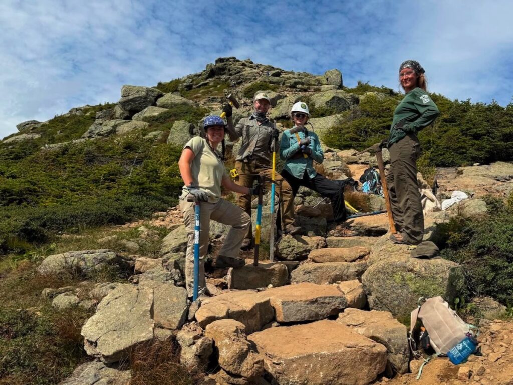
Summit Stewards are uniquely positioned to play this role. They already devote less busy days to trail work. With additional training, stewards could tackle more technical projects, like rebuilding rock steps.

And of course, there is string fencing to replace, waterbars to clean, and signage to refresh. Stewards currently complement trail work with indirect management: providing information, education, and interpretation to visitors; conducting environmental and social monitoring; leading volunteers; and working closely with AMC Alpine Stewards and USFS Trailhead Stewards. All of this is coordinated with and overseen by the USFS. Trail-based management is further complemented by administrative policies such as potential visitor use limits, group-size limits, and parking/shuttle management in Franconia Notch State Park.

Taken together, this is integrated trail management: trail tending.

The Limits of “Big Project, Big Funding”

This vision stands in contrast to the recent model of massive, multi-crew projects focused only on trail reconstruction. The Crawford Path project and the current Franconia Ridge partnership exemplify this “big project, big funding” approach. While it may sustain large trail departments, the results are mixed: work quality varies, and when the money runs out, crews disappear—finished or not. Worse, it feeds what I call the engineer’s conceit: the idea that if you just build a trail “right,” the job is done.

Good engineering and design do matter—Inca stonework in South America has endured for a thousand years, a testament to what careful construction can achieve. But no trail, however well built, is ever truly “finished.” Every trail requires constant revisiting, with regular maintenance, and adjustment and adaptation over time as climate and use patterns change. One reason so many White Mountain trails are in poor condition is that trail maintenance has been segregated from trail construction and reconstruction and treated as second-class work, rather than as the heart of stewardship.

The Role of Summit Stewards

Nearly five years ago, when “restoration” funds for the Franconia Ridge Loop first appeared, the Summit Steward program was excluded from sharing in the grant—because at the time the USFS and AMC did not consider stewardship “tread work.” I believed then, and still believe now, that this was a mistake. Over the four years of the partnership, it is Summit Stewards and volunteers who have in fact done the only tread work on the Franconia Ridge Trail itself.

Thankfully, the USFS has come to recognize this and has increased its funding for the Summit Steward program. The Waterman Fund has been a consistent supporter. Even so, it remains a struggle to find enough funds to keep Summit Stewards on Franconia Ridge every year.

Looking Forward

As the Partnership to Restore Franconia Ridge Loop winds down, we should not be chasing ever-larger grants to stage logistically complex projects that vanish when the money dries up. Instead, let’s invest in a dedicated cohort of specially trained Summit Stewards—small, skilled teams who can continually rebuild, adapt, and maintain the Franconia Ridge Trail.

The alpine zone demands nothing less.

  1. The Appalachian Mountain Club (AMC) professional crew did some excellent work building scree wall and and cairns on the summit of Lafayette and on the upper Greenleaf Trail, and recently an AMC led Vermont Youth Conservation Corp crew did equally high-quality work on the upper Greenleaf Trail. But no work has gone beyond the summit of Lafayette on the Franconia Ridge itself. ↩︎

Hiker Flow on Franconia Ridge: A Fluid Dynamics Analogy

From the September 3, 2025 issue of the Raven

A Chance Encounter

Over the last ten years of intensive focus on Franconia Ridge I have come to refer to the surge of hikers and runners that stewards see on popular weekend days as “the wave.” During seminars and while doing field work this year, students and trails fellows began to expand this analogy, seeing hikers “flow” across the Ridge and summits and pullouts as “eddies.”

A chance encounter on Franconia Ridge almost two weeks ago sparked me to take this analogy to a new level. I met a hiker whose field of expertise is in biosignal processing and nonlinear systems analysis, who studies physiological flows like heart rhythms and arterial turbulence. We corresponded after, and he asked if I thought the Navier–Stokes equations might apply to trails.

The Navier–Stokes equations are the fundamental mathematical description of how fluids (like air or water) move, capturing the balance between inertia, pressure, viscosity, and external forces. That question encouraged me to pull together a few ideas I’ve been developing over the decade and consider how this analogy might help us build a model for off-trail surges on Franconia Ridge.

Fluid Dynamics as Analogy

The Navier–Stokes equation can be a surprisingly useful analogy for hiker flow. At its core, fluid dynamics helps us think about how many individual “particles” moving together generate collective patterns like laminar flow, turbulence, eddies, and surges. Those patterns map well onto what we see on high-use trails: smooth movement when hikers are well spaced, congestion when they bunch up, and sudden bursts of off-trail departures when local density rises too high.

From Pipes, to Arteries, to Rivers

Pipes are rigid: too much pressure and they burst, too little and they collapse (Venturi effect). This is a binary, mechanical mode of failure — the pipe is intact, or it has catastrophically failed.

Arteries are elastic: adaptive, but also prone to nonlinear thresholds. Turbulence interacts with narrowing walls, so small changes in flow can lead to sudden constriction or occlusion. This resembles the way off-trail departures spike once density passes a tipping point (Lee et al., 2012).

Rivers are adaptive: porous banks allow flow to respond to terrain, and excess volume produces meanders and braids. Trails behave the same way: instead of bursting, they widen and braid under pressure (Wimpey & Marion, 2010).

This progression — pipe, artery, river — shows why rivers may be our best analogy, while physiology reinforces why nonlinear thresholds must be central to our models.

Thresholds and Nonlinear Dynamics on Franconia Ridge

Field observations align with this systems view. On busy weekends, the sequence:

A morning wave of hikers enters the loop, creating a density surge that moves across the Ridge like a flood pulse → At first, flow remains laminar: hikers stay mostly on-trail → Once a density threshold is exceeded, behavior changes suddenly: hikers step off to pass, to rest, or to avoid crowds → Off-trail departures spike nonlinearly, resembling a bifurcation event (Helbing et al., 2000) → Impacts grow disproportionately: a modest increase in hikers per hour results in a dramatic rise in trampling and braiding.

This is the hallmark of a complex adaptive system. Like turbulence in arteries or overbank flooding in rivers, trail impacts emerge abruptly once thresholds are crossed.

Above: Managers could try reducing the wave through timed entry or permits. In the above graph you can see this doesn’t necessarily get us out of the red zone (off-trail surge). Another approach would be to try to raise the critical density threshold through other direct management (widening the trail, adding string fencing, decreasing rugosity, etc.) or through indirect management (signs, stewards, education campaigns). If you would like to see how different management strategies and changing different variable, try this interactive model (click on graphic above). Note: this is a much simpler model than the ABM mentioned below.

Using Agent-Based Modeling to Anticipate Outcomes

Because averages obscure these nonlinear spikes, managers need modeling approaches that capture thresholds and feedback. Agent-based modeling (ABM) offers a promising tool.

How it works: each hiker is modeled as an “agent” with simple rules — walking speed, group size, comfort with crowding, probability of stepping off-trail under certain densities or slopes.

Wave dynamics: by varying start times at trailheads, the model can simulate the morning “pulse” of hikers moving across the Ridge, showing when and where local densities approach critical thresholds.

Threshold behaviors: ABM has already been used in visitor management for protected areas (Štekerová et al., 2022) and in crowd science to capture nonlinear “panic” or “jam” effects (Helbing et al., 2000). Similar approaches have shown how social groupings change crowd flow (Moussaïd et al., 2010) and how physiological factors shape pedestrian trajectories (Narang et al., 2015).

Testing interventions: scenarios can be run for permit or timed-entry systems, steward placement at key “eddies,” trail design changes, or communication tools like signage and steward contact.

This mirrors river management, where levees, diversions, and floodplains work together. It also reflects physiology, where resilience depends on both vessel walls and regulatory signals.

Interpretive sign in pull-out area

A Systemic View of the Loop

The river analogy encourages managers to take a whole-system view of the Franconia Ridge loop:

Inputs: parking, shuttles, and trailhead access determine the size and timing of the hiker “wave.”

Regulation: permits, timed-entry systems, shuttle timing can flatten the morning surge, lowering the chance of threshold crossing. 

Trail design: side-hill alignment, wider trails, scree walls, string fencing.

Local controls: stewards act as “regulators,” dampening turbulence at critical points and educating visitors.

Above treeline, where realignment away from fall-line routes may not be feasible, these systemic and social interventions are crucial to protecting the three miles of alpine zone on the Franconia Ridge Loop that are most at risk.

Conclusion

Trails behave less like pipes waiting to burst and more like rivers whose channels expand and braid under pressure. The artery analogy reminds us why thresholds matter: small changes can trigger nonlinear shifts with outsized impacts.
By adopting this systemic, nonlinear perspective, managers can better anticipate surges, identify bifurcation points, and deploy layered interventions. This is the essence of Integrated Trail Management (ITM): combining design, education, regulation, and stewardship to create resilience in the face of growing use.

Just as rivers are managed through levees, diversions, and floodplains, and arteries rely on both vessel strength and systemic regulation, Franconia Ridge can be managed through a mix of direct and indirect tools. The goal is not to eliminate flow, but to channel it wisely, preserving fragile alpine ecosystems.

Looking ahead, agent-based modeling (ABM) can help managers simulate how hikers move across the Ridge, anticipate where thresholds are crossed, and test interventions virtually before applying them on the ground. By linking trail design, administrative tools (permits, timed entry, shuttle schedules), and policy measures (group size limits, steward placement) into a single systemic framework, ABM provides a way to identify the most effective combinations. In this way, science, design, and governance reinforce one another — giving us a path toward both protecting the alpine zone and sustaining the experience of those who visit it.

References

Cole, D.N. (1995). Experimental trampling of vegetation: Predictors of resistance and resilience. Journal of Applied Ecology, 32, 215–224.

Helbing, D., Farkas, I., & Vicsek, T. (2000). Simulating dynamical features of escape panic. Nature, 407, 487–490. https://doi.org/10.1038/35035023

Marion, J.L. (2016). A review and synthesis of recreation ecology research supporting carrying capacity and visitor use management decisionmaking. Journal of Forestry, 114(3), 339–351.

Marion, J.L., Park, L.O., & Wimpey, J. (2022). Efficacy of Combining Education and Site Management in Reducing Off-Trail Travel in a Fragile Biotic Community, Acadia National Park. Journal of Interpretation Research, 28(1), 26–45.

Moussaïd, M., Perozo, N., Garnier, S., Helbing, D., & Theraulaz, G. (2010). The walking behaviour of pedestrian social groups and its impact on crowd dynamics. PLoS One, 5(4), e10047. https://doi.org/10.1371/journal.pone.0010047

Narang, S., Best, A., Curtis, S., & Manocha, D. (2015). Generating pedestrian trajectories consistent with the fundamental diagram based on physiological and psychological factors. PLoS One, 10(4), e0117856. https://doi.org/10.1371/journal.pone.0117856

Park, L.O., Manning, R.E., Marion, J.L., Lawson, S.R., & Jacobi, C. (2008). Managing visitor impacts in parks: A multi-method study of the effectiveness of alternative management practices. Journal of Park and Recreation Administration, 26(1), 97–121.

Rupf, R., Haegeli, P., Karlen, B., & Wyttenbach, M. (2019). Does Perceived Crowding Cause Winter Backcountry Recreationists to Displace? Mountain Research and Development, 39(1), R60.

Štekerová, K., Zelenka, J., & Kořínek, M. (2022). Agent-Based Modelling in Visitor Management of Protected Areas. Sustainability, 14(19), 11853. https://doi.org/10.3390/su141911853

Lee, J., Nemati, S., Silva, I., Edwards, B.A., Butler, J.P., & Malhotra, A. (2012). Transfer entropy estimation and directional coupling change detection in biomedical time series. Biomedical Engineering Online, 11(1), 19. https://doi.org/10.1186/1475-925X-11-19

Wimpey, J., & Marion, J.L. (2010). The influence of use, environmental and managerial factors on the width of recreational trails. Journal of Environmental Management, 91(9), 2028–2037. https://doi.org/10.1016/j.jenvman.2010.05.017

From only me, to we

“To begin with oneself, but not to end with oneself; to start from oneself, but not to aim at oneself; to comprehend oneself, but not to be preoccupied with oneself.”
— Martin Buber

Jess and Demi’s reports and photos from last weekend on Franconia Ridge left me disheartened. Graffiti on rocks and ledges, an abandoned tent in the alpine zone, the usual overcrowded summits—and then, astonishingly, someone who had hauled a rowing machine to the ridge. Taken together, these images left me stunned. I try to recognize that people experience and enjoy the outdoors in different ways—often very different from what I would choose. But the risk in sliding too far into relativism is that we lose our ethical grounding.

Aldo Leopold offers one of the simplest and most direct definitions of ethics: 

“All ethics so far evolved rest upon a single premise: that the individual is a member of a community of interdependent parts. His instincts prompt him to compete for his place in that community, but his ethics prompt him also to cooperate…”
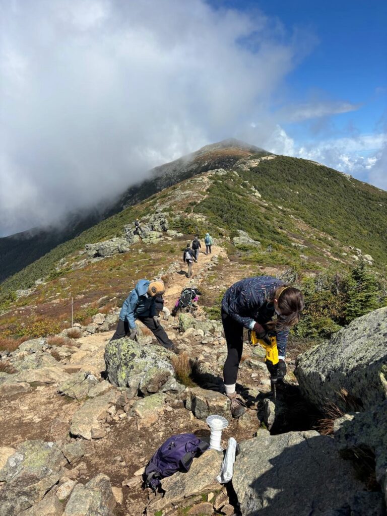
In one of the graffiti scrawls I saw the words “Only me.” Whether that was what the author intended to write, it seemed fitting: a declaration of narcissism. In a world of “only me,” there is no community, no sense of responsibility, no ethics.
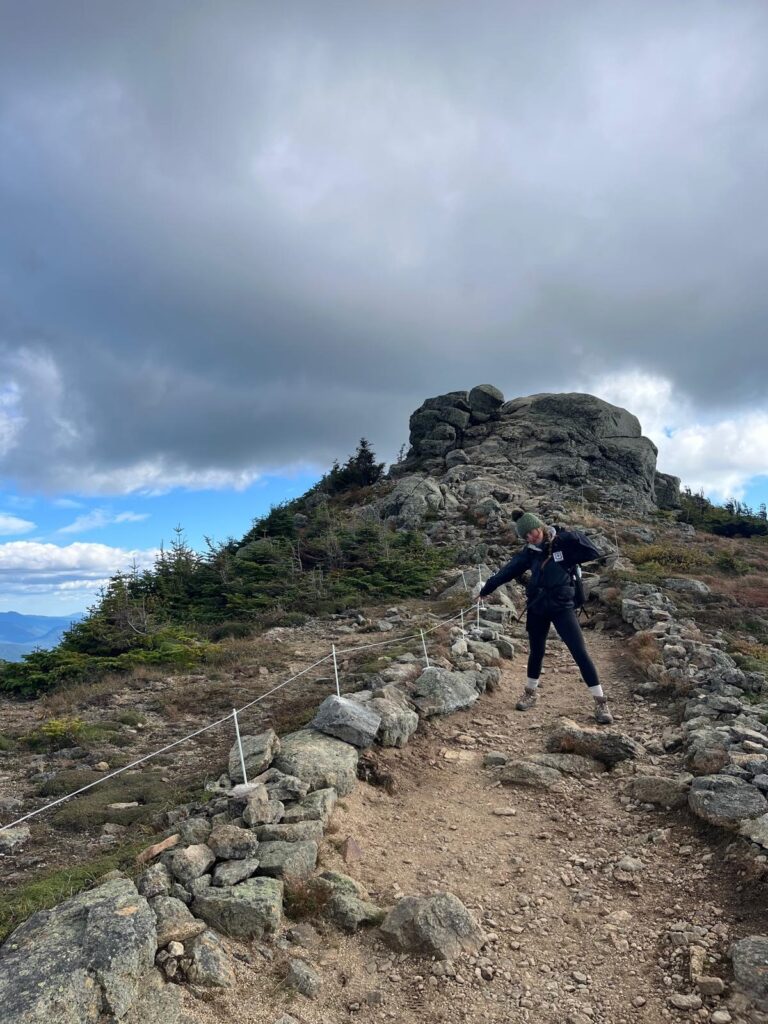
Leopold believed ethics can and must expand beyond human-to-human relations: “The land ethic simply enlarges the boundaries of the community to include soils, waters, plants, and animals, or collectively: the land.”

To stand on Franconia Ridge is to recognize and respect not just the thousands of fellow hikers, but also the alpine plants, the ravens and other wildlife, the thin, fragile soils, the brooks and streams rushing down into the Pemigewasset Wilderness. All are part of our community.
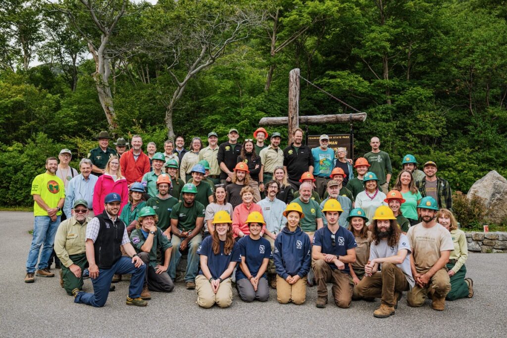
Trophies

Leopold also spoke of a conservation “esthetic,” the idea that recreation in nature could cultivate deeper values. He discussed how seeking “trophies” can connect people to the land. He distinguished between direct and indirect trophies.

A direct trophy is something extracted from the land—antlers, a trout, a pressed flower. This can be sustainable when taken sparingly, but they consume what they commemorate. By contrast, an indirect trophy—a photograph, a field sketch, a journal entry—leaves the land intact. For Leopold, indirect trophies marked a step toward ethical maturity: they satisfied the desire for memory while protecting the resource.

But on Franconia Ridge today, indirect trophies are no longer harmless. The summit selfie, once a private snapshot, has become a mass ritual. The “4000 Footer” list turns a personal memory into a public badge, fueling competition and overrunning some fragile summits just because they have surpassed an elevational threshold. Social media magnifies the effect: a single TikTok or YouTube of someone rowing on Franconia Ridge or posing in an alpine meadow can summon hundreds of imitators. The land is not consumed by the photo itself, but by the trampling, crowding, and performance required to produce it.

From I–It to I–Thou

Direct or indirect, trophies reduce nature to an object that we stand apart from, connected only in a utilitarian way. We press the flower, post the photo—each becomes something we possess rather than a relationship we enter into. This is what the philosopher Martin Buber warned against in his description of the I–It relationship, where others we encounter in the world—whether part of the natural world or people—are reduced to objects for our use.

A land ethic, by contrast, draws us into what Buber called the I–Thou relationship—an encounter rooted in reciprocity and respect, where soils, waters, plants, and animals are not “its” but fellow members of a shared community. Here the flower is left to bloom, the photograph held as a reminder rather than a badge. The experience is not about possession, but about participation in a living whole.

We

Leopold hoped that indirect trophies might nurture a conservation ethic, cultivating appreciation that deepens our connection to land. For us, the task is to rediscover that possibility in a digital era where images multiply endlessly and summit challenges have become part of our outdoor culture. Could the 4000-footer traditions—in all their variations, from winter ascents to the Direttissima—be embraced not only as personal achievements, but also as pathways to deeper care for the mountains themselves? Could photos be gestures of reverence as much as a celebration of achievement? Could our stories and records highlight the alpine community that makes these places so meaningful?

Sometimes the most ethical choice lies not in what we do, but in what we refrain from doing. Restraining the impulse to claim a trophy—whether it is a photograph, a peak, or a list completed—can be a gesture of respect when we recognize that our action might cause harm. At times, deciding not to climb or run an already overburdened summit may be the wisest course. In the same way, choosing not to post a photo or video on social media—resisting the pull of performance—can itself be an ethical act, a gesture of humility toward both the land and our human community.

The graffiti on Franconia Ridge reminds us of what is at stake. To move from “Only me” to “we” is to recognize that Franconia Ridge is not a stage for performance, but a living community—one to which we belong, and for which we share responsibility.

Selected Bibliography

Leopold, Aldo.

  • A Sand County Almanac and Sketches Here and There. Oxford University Press, 1949.
     —Seminal collection of essays in which Leopold articulates his concept of a “land ethic,” calling for a responsible relationship between people and the land they inhabit.

Buber, Martin.

  • I and Thou. Translated by Walter Kaufmann, Charles Scribner’s Sons, 1970. Originally published as Ich und Du, 1923.
     —Foundational philosophical work exploring the nature of relationships, particularly the contrast between “I–It” (objectifying) and “I–Thou” (relational) modes of being.

Additional Resources

  • Flader, Susan L. Thinking Like a Mountain: Aldo Leopold and the Evolution of an Ecological Attitude toward Deer, Wolves, and Forests. University of Wisconsin Press, 1994.
  • Friedman, Maurice S. Martin Buber: The Life of Dialogue. University of Chicago Press, 2002.