How We Got Here: The Historical Roots of the White Mountains Trails Crisis

Nat Scrimshaw 

This article continues a series examining the Franconia Ridge Loop Restoration and what that experience can teach us about the future of trail management in the White Mountains.

  1. Five Years of the Partnership to Restore Franconia Ridge
  2. What We Did Right in the Franconia Ridge Loop Restoration
  3. What We Could Have Done Better: Lessons from the Franconia Ridge Loop Restoration
  4. How We Got Here: The Historical Roots of the White Mountains Trails Crisis? (below)
  5. Rethinking the White Mountain Trail Management System (to come)

In this essay

In the previous articles, I reflected on what we accomplished through the Partnership to Restore the Franconia Loop, what we did well, and where I believe we fell short. For some readers, the critique may have been startling given the extraordinary resources invested in the project. By the time the work is fully accounted for, nearly $2 million will have been invested in the Franconia Ridge Loop.

I believe what we achieved was tremendous, and we should not diminish those accomplishments. But neither should those accomplishments prevent us from confronting what I believe are structural problems in the way we restore and maintain trails in the White Mountains.
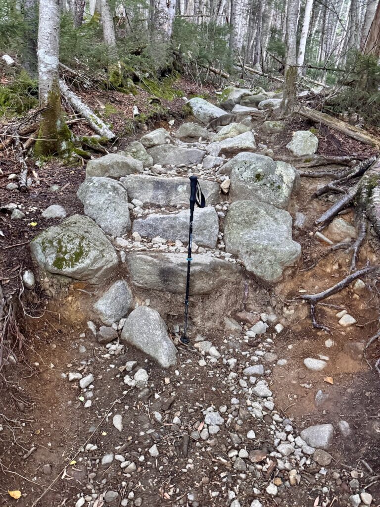
We are facing something of a perfect storm: steadily increasing recreational use, a changing climate with more intense rain events, limited public funding, changing nonprofit priorities, and the particular geography and geology of the White Mountains, all acting upon a trail system whose basic alignments and management traditions were established generations ago.

To understand this problem, I think we need to understand how we got here.

My perspective is inevitably personal. I have worked on White Mountain trails for more than 50 years. But the story begins much earlier, with the creation of the recreational trail system itself.

Trails as Socio-Ecological Systems

We usually think of a trail as something physical: a tread winding through a particular geography and ecology, shaped by soils, rocks, vegetation, water, weather and climate. But trails are also socio-ecological systems. The physical trail intersects with culture, economics, technology, institutions and human behavior.

Why people go to the mountains, how they get there, what they expect to find when they arrive, how many people come, who pays for trails, who maintains them, and even what people believe a mountain trail should feel like all influence what happens to that strip of ground.

Traditional recreation ecology gives us important tools for studying visitor impacts and behavior. But I think we need to go further. We also need to understand the cultural, economic, technological and demographic forces producing that behavior. In the White Mountains, that story begins in the nineteenth century.

A New Idea of Nature, Trains and a Middle Class

Three transformations during the nineteenth century helped create the White Mountain recreational economy: a changing cultural understanding of nature, a transportation revolution, and the emergence of an urban middle class with some disposable income and leisure time.

The cultural transformation is often associated with Transcendentalism, born here in New England, but it was broader than that. Romanticism, ideas of the sublime, landscape painting and nature writing all contributed to a profound change in the way Americans understood wild landscapes. Mountains and forests, once regarded primarily as obstacles, resources, or places to be brought under human control, acquired another meaning. Wildness could have spiritual value. Mountains could be places of contemplation, physical challenge, health and renewal. They became places of re-creation.

At roughly the same time, railroads transformed who could reach them. Rail access from Boston and other New England cities expanded rapidly during the middle of the nineteenth century. Concord was connected by 1842, Plymouth by 1850, Gorham by 1851 and North Conway by 1874. Journeys that once required difficult combinations of roads and stagecoaches could increasingly be made predictably by rail.

Meanwhile, New England’s economy was changing from one dominated by agriculture, small workshops and maritime commerce toward factories, cities, finance and wage labor. The benefits were by no means equally distributed, and extended vacations remained largely the privilege of the prosperous and emerging middle class. Nevertheless, something new had appeared: a growing urban population with both the desire and, increasingly, the means to escape the city for recreation.

The White Mountains became one of America’s earliest major mountain vacation regions. Grand hotels, boardinghouses, guides and stage services grew around the new visitors. Summer communities developed. And once people arrived, they wanted places to walk.

The Trail Clubs Build a Recreational Landscape
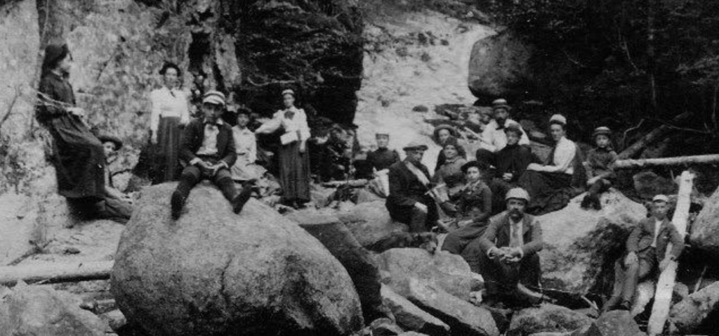
What followed was one of the defining features of White Mountain history: the proliferation of organizations devoted to creating and maintaining recreational trails.

The White Mountain Club of Portland was organized in 1873, the Appalachian Mountain Club in 1876, the Waterville Valley Athletic and Improvement Association in 1888, the Wonalancet Out Door Club in 1892, the Squam Lakes Association in 1904, the Dartmouth Outing Club in 1909 and the Randolph Mountain Club in 1910. Other organizations followed. With the exception of the White Mountain Club of Portland, these organizations continue in some form today.

Here my own family history intersects with this larger history. My great-grandfather, Arthur Goodrich, was a charter member of the Appalachian Mountain Club and became the first president of the Waterville Valley Athletic and Improvement Association in 1888. Waterville developed what may have been the country’s first true interconnected system of recreational trails.

These clubs weren’t maintaining trails provided by government. They were creating the recreational landscape itself. They chose destinations, selected routes, cut trails, constructed shelters and published maps and guidebooks. In doing so, they also developed ideas about what hiking should be. That last point matters enormously today.

Edmands and Hart: What Is a Trail For?

By the end of the nineteenth century, an interesting disagreement had emerged within White Mountain trail culture. It concerned something more fundamental than how to build a trail. The underlying question was: What is a trail for? Two extraordinary figures provide contrasting answers: J. Rayner Edmands and Warren W. Hart.

Edmands, an MIT-trained engineer and early AMC leader, was one of the most meticulous trail builders in White Mountain history. His paths climbed gradually, winding across slopes rather than heading directly uphill. He carefully graded tread and, above treeline, rearranged rocks to create remarkably stable walking surfaces. Cairns were positioned with similar precision. The Randolph Path, northern Gulfside Trail and Edmands Path still preserve his influence.

But why did Edmands build trails this way?

The answer isn’t entirely clear. Guy and Laura Waterman suggest several possible influences. Edmands had traveled in the West and observed graded mountain trails there. His wife’s physical limitations may have influenced his desire to make mountain paths easier to travel. It has also been suggested that he believed making the mountains accessible to more people could build public appreciation for them at a time when destructive logging threatened the White Mountains.

We should be cautious about assigning any one of these motives too much weight. What we can see much more clearly is what Edmands actually built.

Edmands seems to have understood a trail primarily as a means of passage through the mountains.

The mountain itself provided the wildness, difficulty and grandeur. The trail did not need to add unnecessary obstacles. His job as a trail builder was to find an intelligent route through the terrain and then construct a footway that allowed people to travel it. His oft-quoted principle, “Always rising, never steeply,” captures that philosophy remarkably well.

His reasons were not the same as ours. Edmands wasn’t considering climate resilience, recreation ecology or sustainable trail design in the modern sense. Nevertheless, the physical consequences of his philosophy look strikingly contemporary: follow the contours, moderate the grade, create a stable tread, and work with the terrain rather than simply clearing a route toward the summit.

Not everyone approved.

To some of Edmands’s contemporaries, these carefully engineered trails were too civilized. One early hiker contrasted the older “rough, scratchy” paths with Edmands’s trails, where hikers supposedly streamed up the mountain like a “transplanted tea party.” AMC itself noted in 1900 that it did not intend to construct Edmands-style smooth, graded “boulevards.”

A few years later, Warren Hart gave that idea spectacular physical form. As AMC’s Councillor of Improvements from 1908 to 1910, Hart and his crews developed an extraordinary constellation of trails in the Great Gulf, including Six Husbands, Adams Slide, Buttress, Wamsutta and Madison Gulf. Hart deliberately sought dramatic terrain. His trails climbed steep ridges, slides and ravines.

Difficulty was part of the experience

The Watermans write that while many trail builders were concerned with the comfort of future walkers, Hart wanted to challenge their imaginations. His trails brought hikers into direct contact with the roughness and wildness of the mountains.

So perhaps the Edmands-Hart contrast is best understood not as two different construction techniques, but as two different ideas of what a trail itself contributes to the mountain experience.

For Edmands, the trail was principally a passage through wild terrain. Good design allowed the hiker to experience the mountain without making the footway unnecessarily difficult.

For Hart, the trail could become part of the adventure itself. Its steepness, roughness and audacity could intensify the experience of wildness.

Edmands’s approach remained an exception in the White Mountains. The rougher tradition became deeply embedded in White Mountain hiking culture. We still celebrate “White Mountain miles,” rocks, roots, mud, scrambles and enormous stone steps. Difficulty has become part of the regional hiking identity.

However, a trail that is intentionally challenging is not the same thing as a trail that is physically sustainable.

That distinction mattered relatively little when a steep mountain path received modest use. It matters enormously when tens of thousands of people travel the same alignment every year. Boots loosen soil, water follows the trail downhill, rocks and roots emerge, hikers bypass obstacles, and the corridor widens. Add increasingly intense rainfall and the process accelerates.

What was once simply a rugged trail, under sustained heavy use, becomes an eroded trail.

And this is where Edmands suddenly seems surprisingly relevant more than a century later. We do not need to adopt his particular aesthetic or turn the White Mountains into a network of carefully manicured “boulevards.” But perhaps we need to recover the question that seems to have guided his work:

What does the trail actually need to do?

Sometimes its purpose may indeed be to offer challenge and adventure. But on a trail carrying tens of thousands of people through vulnerable terrain, its most important job may be something closer to Edmands’ conception: to provide a durable passage through the landscape while protecting the mountain landscape around it.

A New Player: The Federal Government

The next great transformation was institutional.

By the turn of the twentieth century, intensive logging and forest fires had devastated portions of the White Mountains. Trail clubs and conservation organizations that had helped create the recreational landscape also became advocates for protecting the landscape itself. The Weeks Act of 1911 authorized federal purchase of forest lands at the headwaters of navigable streams. Land acquisition in the White Mountains followed, and the White Mountain National Forest was formally established in 1918.

This fundamentally changed the institutional landscape, but it did not mean that government simply took over the trails. The recreational trail system predated the National Forest. The clubs, communities and organizations that had built it did not disappear when federal ownership arrived.

Instead, something unusual evolved. The federal government increasingly owned and managed the land, while nonprofit organizations and local trail clubs continued to maintain trails, operate facilities, organize volunteers and bring generations of accumulated knowledge to particular places.

The foundations were being laid for what we would now call a cooperative trail management system.

It was not created from a master plan. It grew organically from history. Government arrived after the trail clubs, and rather than replacing them, increasingly worked alongside them.

The Appalachian Trail and Cooperative Management

Then came an experiment on a continental scale.

Benton MacKaye proposed the Appalachian Trail in 1921, and the Appalachian Trail Conference was organized in 1925 to coordinate the growing network of clubs building the route from Georgia to Maine. From the beginning, volunteers and trail clubs played a central role in creating and caring for the trail. That cooperative tradition eventually developed into today’s formal management system involving the National Park Service, U.S. Forest Service, state agencies, the Appalachian Trail Conservancy and trail-maintaining clubs.

The relationship between this model and the White Mountains ran in both directions. White Mountain trail clubs had already demonstrated that nonprofit organizations and volunteers could create and maintain extensive public trail networks. The Appalachian Trail took that principle and organized it across thousands of miles and many jurisdictions. In turn, the AT helped reinforce and eventually formalize the cooperative model in places such as the White Mountains.

Today the National Park Service explicitly describes the Appalachian Trail as managed through a “cooperative management system.” Agreements underlying that partnership date to the 1930s, while federal legislation in 1968 and 1978 created the foundations of the modern system.

It was, and remains, a remarkable achievement. But it also embedded an assumption that becomes important later in our story: a substantial portion of the physical care of a public recreational resource could be provided through nonprofit organizations and volunteer labor.

Depression, War and a Changing Federal Role

The next two decades complicate any simple story of steadily increasing recreation.

The Great Depression certainly reduced the private means available to many people for travel and recreation. But it simultaneously brought an extraordinary expansion of public investment in conservation and recreational infrastructure. New Deal programs, particularly the Civilian Conservation Corps, put people to work building and improving trails, shelters, roads, campgrounds and other facilities on public lands.

For a time, government had something that today’s trail managers can only dream about: enormous numbers of people whose job was to care for public landscapes.

World War II reversed much of that. CCC operations ended, labor and materials were redirected to the war effort, and gasoline rationing and travel restrictions reduced recreational mobility. Nationally, recreation visits to National Forests fell from roughly 18 million in 1941 to around 6 million during the war. But this was a pause, not a reversal. When the war ended, an entirely different era of outdoor recreation began.

What If Edmands Had Prevailed?

Before following that story, it is worth returning briefly to Edmands.

What if his philosophy of carefully graded, contouring trails had become more influential in the White Mountains?

Our trails would probably be longer. They would traverse slopes more frequently. We would have more climbing turns and fewer direct ascents. Perhaps the White Mountains would feel somewhat less rugged. But we might also have inherited more trails whose basic alignments were better suited to the extraordinary levels of recreational use that were about to arrive.

That doesn’t mean Edmands was right and Hart was wrong. Nor does it mean an Edmands trail would somehow be immune to the impacts of modern use. Hart was designing an experience as much as a footway, and the rugged mountain experience his trails helped define is now an important part of White Mountain culture.

Neither man could have imagined the conditions under which these trails would operate more than a century later. The problem isn’t that our predecessors built the wrong trails.

The problem is that the world around those trails changed.

The Coming of the Lug-Soled Army

Guy and Laura Waterman gave the postwar transformation a memorable name: “The Coming of the Lug-Soled Army.” It is the title of a chapter in their Backwoods Ethics, and it captures an essential point in the history of recreational impact. Practices that had once caused relatively little damage when undertaken by a small number of hikers could have very different consequences when repeated by thousands.

After World War II, American recreation changed at extraordinary speed. Rising incomes, paid vacation time, widespread automobile ownership, improved highways, inexpensive gasoline, suburbanization and increasingly sophisticated outdoor equipment made the mountains accessible to far more people.

Nationally, recreation visits to National Forests rose from approximately 18 million in 1946 to more than 100 million by 1961, more than a fivefold increase in only fifteen years. The Forest Service itself later described the postwar period as the beginning of modern recreation on the National Forests and acknowledged that the agency struggled to keep pace with the surge.

The old rail-based tourism geography also gave way to an automobile geography. Instead of spending weeks at a grand hotel or boardinghouse, visitors could drive from Boston and other metropolitan areas, hike a mountain and return home. The mountains became accessible not simply to vacationers but to an expanding population of weekend recreationists.

The lug-soled army had arrived. And it kept growing.

By the late 1960s, the White Mountains were experiencing a backpacking boom severe enough to overwhelm an important part of the existing management system. AMC’s shelters and campsites faced increasing litter, proliferating campsites, sanitation problems and ecological damage. In 1970, AMC placed a seasonal caretaker at Liberty Springs, beginning what became its backcountry caretaker program. The caretaker wasn’t simply there to maintain a facility. Education, trail work, sanitation, restoration and managing visitor behavior became parts of the same job.

This was an early warning of the problem we face today.

The Twenty-First-Century Acceleration

The growth did not stop with the backpacking boom. Automobiles and highways continued to shrink the effective distance between the mountains and major population centers. Outdoor equipment became lighter and more accessible. Trail running and winter hiking expanded the seasons of use. And then digital technology changed the informational landscape.

Maps, GPS, websites, social media and eventually hiking apps dramatically reduced the knowledge once required to find and navigate a mountain trail. A visitor no longer necessarily needed a hiking club, an experienced companion, or even a guidebook to discover a route and follow it.

Then came COVID-19.

The pandemic did not create America’s interest in outdoor recreation, but it clearly accelerated it. University of New Hampshire researchers found that outdoor recreation visitation in New England National Forests increased by more than 60 percent during the summer of 2020, representing roughly two million additional visitors, most from out of state. Researchers documented associated social and ecological impacts as managers struggled with the sudden increase.

Some of that extraordinary pandemic surge subsided. But on Franconia Ridge, our own visitor counts show that very high use is not simply a 2020 anomaly. It is now part of the management environment.

We Inherited More Than the Trails

This brings us to what I think is the central historical lesson. We inherited not one thing, but three.

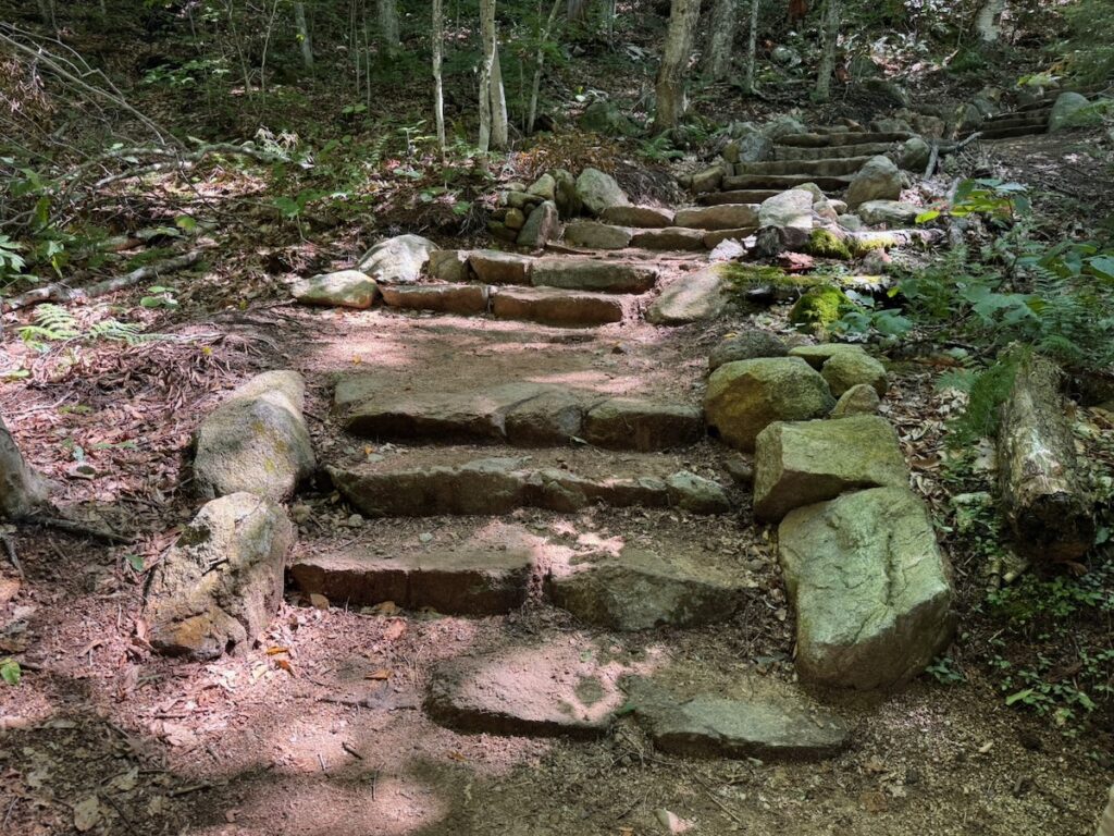
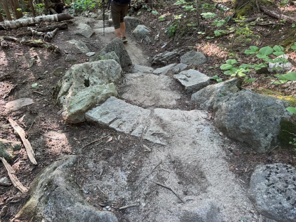
First, we inherited a nineteenth- and early twentieth-century physical trail network, often steep, rocky and direct, built when recreational use was dramatically lower. Many of these trails are wonderful. Their routes, stonework, scrambles and peculiarities are part of the character of hiking in the White Mountains. But their original alignments were not designed for the numbers of people, or the environmental conditions, they experience today.

Second, we inherited a culture of hiking that values ruggedness and difficulty. The Hart tradition, broadly understood, became part of what distinguishes White Mountain hiking. Rocks, roots, mud, scrambles, steep climbs and “White Mountain miles” aren’t simply inconveniences. For many hikers, they are part of what makes these mountains special. Difficulty can confer authenticity: if the trail is hard, rocky and unforgiving, it somehow feels more genuinely White Mountains.

That culture is worth preserving. But it can also make us reluctant to distinguish between difficulty that contributes to the experience and difficulty that results from poor alignment, erosion or deterioration. A scramble up a dramatic rocky ridge may be precisely what we want to preserve. A deeply eroded fall-line trail doesn’t become valuable simply because it is difficult to walk.

Third, we inherited a management system whose roots lie in the same period: public agencies, nonprofit trail organizations, local clubs, professional crews and an extraordinary amount of volunteer labor working cooperatively to care for a shared recreational resource.

There is much to admire in that system. Its durability is remarkable. Organizations have cared for particular mountains and trails for more than a century. Volunteers have contributed enormous amounts of labor. Local knowledge has accumulated across generations. The Appalachian Trail turned cooperative management into one of the great experiments in public-private stewardship in the United States, and that model remains very much alive today.

But a management system can be historically successful and still become mismatched with changing conditions. The cooperative system developed when recreational use was lower, trail construction was comparatively inexpensive, volunteer maintenance could address much of the routine workload, and deterioration often occurred slowly enough for periodic intervention.

All three inheritances now interact.

We have a legacy trail network carrying levels of use for which it was never designed. We have a hiking culture that can sometimes make fundamental trail redesign difficult to contemplate. And we have a cooperative management system whose institutions, funding mechanisms and division of responsibilities evolved under very different conditions.

None of these inheritances is something I would want to discard. The question is how we carry forward what is valuable in each of them while changing what no longer works.

A Perfect Storm

We now have an inherited network of steep, rocky legacy trails carrying levels of use their builders could never have imagined. More intense rainfall places additional stress on drainage and tread. Sustainable professional trail construction has become more sophisticated and expensive. Public resources are limited. Nonprofit organizations have broader missions and competing priorities. Volunteers are sometimes being asked to maintain drainage systems and structures that require attention repeatedly throughout a season. Technology has simultaneously transformed access and visitor behavior.

The result is what I increasingly see as a perfect storm for White Mountain trails.

We cannot solve it simply by recruiting more volunteers to clean more waterbars. We cannot solve it with massive construction projects that leave trails unfinished and without maintenance programs. Nor can we rebuild nineteenth-century trail alignments one damaged section at a time without asking whether those alignments, construction standards and management arrangements still make sense.

We need to decide which historic rugged trails should remain rugged and which high-use trails require fundamentally different design standards. We need to distinguish trails that can reasonably be maintained primarily by volunteers from those requiring continuous professional management. Trail construction needs to be integrated with visitor management, ecological monitoring and stewardship. And whatever we build needs a funding and organizational system capable of maintaining it.

The Franconia Ridge Loop Restoration has helped convince me of this. Nearly $2 million can be invested in one of the most important trail systems in the White Mountains, tremendous work can be accomplished, and five years later we can still find ourselves saying: the work has only begun.

The White Mountains have reinvented their relationship with trails before. Nineteenth-century clubs created recreational trail networks where none existed. The creation of the White Mountain National Forest brought government into a landscape whose recreational infrastructure had largely been created by private organizations. The Appalachian Trail helped develop and formalize an extraordinary cooperative model linking public agencies, nonprofits and volunteers. The postwar recreation boom led to professional trail crews, caretakers and new approaches to visitor education and backcountry stewardship.

Each innovation responded to a new set of conditions.

The question for the next article is not whether we should abandon the cooperative model that has served the White Mountains for more than a century. Quite the opposite. The question is how we reinvent it again.

What would a twenty-first-century cooperative trail management system for the White Mountains actually look like?


Selected Sources and Further Reading

Waterman, Guy, and Laura Waterman. Forest and Crag: A History of Hiking, Trail Blazing, and Adventure in the Northeast Mountains. Appalachian Mountain Club Books, 1989.
The principal historical source for the development of northeastern hiking and trail building, including the contrasting trail-building philosophies of J. Rayner Edmands and Warren Hart.

Waterman, Laura, and Guy Waterman. Backwoods Ethics: Environmental Issues for Hikers and Campers. Stone Wall Press, 1979; expanded edition, Countryman Press, 1993.
Particularly relevant is the chapter “The Coming of the Lug-Soled Army,” examining how increasing numbers of backcountry users transformed the environmental consequences of recreational behavior.

Waterman, Laura, and Guy Waterman. Wilderness Ethics: Preserving the Spirit of Wildness. Countryman Press, 1993.
Extends the Watermans’ thinking from individual low-impact behavior to broader questions of wilderness, stewardship, recreation and management.

U.S. Forest Service / Weeks Act historical materials.
Historical accounts of the Weeks Act of 1911, federal land acquisition in the eastern United States, and establishment of the White Mountain National Forest in 1918.

National Park Service, Appalachian National Scenic Trail. Partners and historical materials on the Appalachian Trail.
Documents the evolution of the AT’s cooperative management system involving the National Park Service, U.S. Forest Service, Appalachian Trail Conservancy, state agencies and volunteer trail clubs.

U.S. Forest Service. Historical recreation-use reports.
Forest Service statistics document the postwar increase in National Forest recreation from approximately 18 million visits in 1946 to more than 100 million in 1961, illustrating the extraordinary scale of the postwar outdoor-recreation boom.

Appalachian Mountain Club. AMC Backcountry Caretaker Program Turns 50.
A useful account of the late-1960s White Mountain backpacking boom and AMC’s 1970 experiment at Liberty Springs, which evolved into the modern backcountry caretaker program.

Ferguson, Michael D., and colleagues, University of New Hampshire. Research on outdoor recreation during the COVID-19 pandemic in New England National Forests.
Documents an increase of more than 60 percent in outdoor recreation visitation during summer 2020 and examines associated social and ecological impacts.

Green Mountain Club. Discussion of the Watermans’ Backwoods Ethics/The Green Guide, Long Trail News, Summer 2017. A useful retrospective on the Watermans’ “lug-soled army” argument and their observation that increasing numbers can transform previously acceptable recreational practices into significant environmental impacts.
What We Could Have Done Better: Lessons from the Franconia Ridge Loop Restoration

Nathaniel Scrimshaw

This is the third in a four-part series reflecting on the accomplishments of the Franconia Ridge Loop Restoration, what we could have done better, and where we go from here.

  1. Five Years of the Partnership to Restore Franconia Ridge
  2. What We Did Right in the Franconia Ridge Loop Restoration
  3. What We Could Have Done Better: Lessons from the Franconia Ridge Loop Restoration
  4. How We Got Here: The Historical Roots of the White Mountains Trails Crisis?
  5. Rethinking the White Mountain Trail Management System (to come)
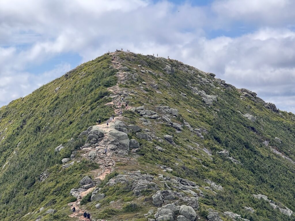
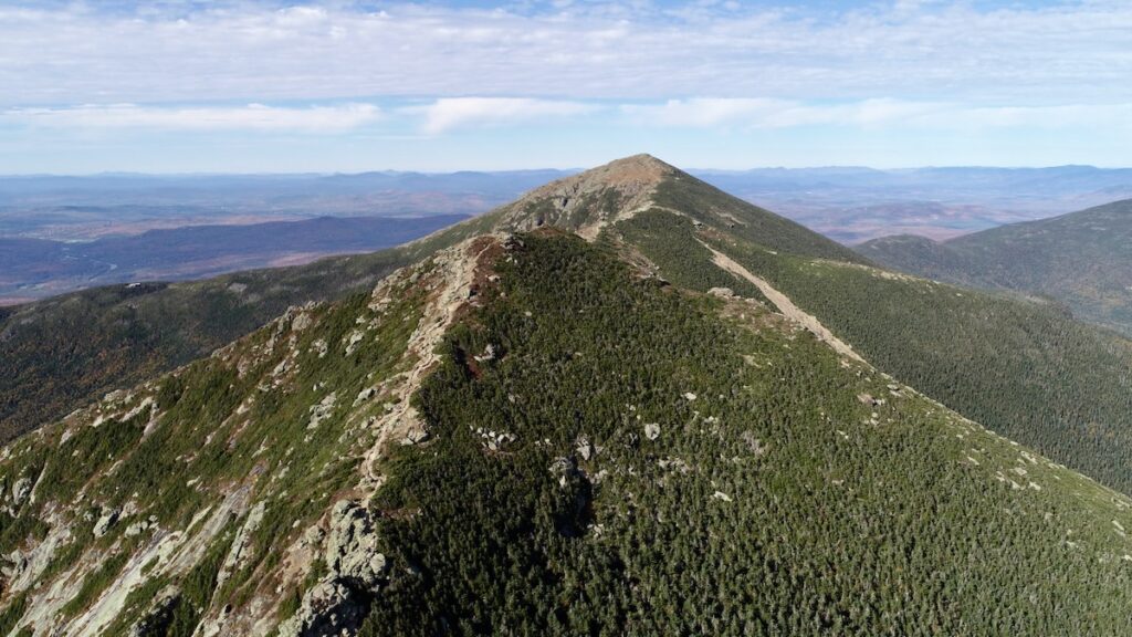
View of the “Lincoln Scrambles South,” Mount Lincoln and Mount Lafayette, on Franconia Ridge.

In the previous article, I discussed some of the things we got right in the Franconia Ridge Loop Restoration: trail realignment, reverse-grade drainage, carefully designed step clusters, foundation steps, full-bench construction, proper tread preparation, and trail widths appropriate for very high levels of use.

Together, these represented an important advance toward a new standard for sustainable trail construction in the White Mountains.

But we did not apply that standard consistently. Understanding why is important, not to diminish what has been accomplished, but because the lessons from this project should inform how we plan the next generation of major trail projects.

An Ambitious Goal Without a Complete Plan

We should begin by acknowledging that the original goal of the project, to “redesign the Franconia Ridge Loop from start to finish,” proved overly ambitious given the available funding and the actual condition and use level of the trail.

As mentioned in the first article in this series, five years later, substantial work remains even on the two major approach trails, Old Bridle Path and Falling Waters Trail. Only a relatively small amount of work has been completed on the upper Greenleaf Trail in the alpine zone. And no congressionally funded restoration work was undertaken on perhaps the most ecologically sensitive portion of the entire Loop: the Franconia Ridge Trail between Mount Lafayette and Little Haystack.

Part of the problem was built into the project from the beginning.

The  $1.125 million in Congressionally Directed Funding was not the result of a detailed assessment of every section of the Loop followed by engineering and trail-design estimates of what it would cost to rebuild it. Rather, it represented the level of funding that could be secured through the congressional appropriations process.

That is understandable. Nothing comparable had previously been attempted on this scale in the White Mountains, and more than a million dollars sounded like an enormous investment in a single trail system.

And it was an enormous investment. It just wasn’t enough to accomplish the stated goal.

The Missing Variable: Use

One reason the cost was underestimated was that we had not fully incorporated the extraordinary volume of use on the Franconia Ridge Loop into our understanding of what reconstruction would require.

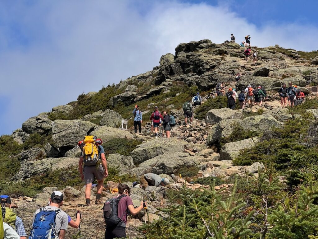
Today the Loop receives approximately 45,000–50,000 visitors between May and October. That changes almost everything about trail design.

Peter Jensen, Peter Jensen & Associates LLC and rocks steps constructed to the original standard we agreed to.

A technique that might perform adequately on a trail receiving a few thousand hikers annually can deteriorate rapidly when thousands of boots pass over it in a matter of weeks. A narrow tread that works perfectly well elsewhere can result in hikers continually stepping around one another. Organic soil that might gradually compact and harden on a lightly traveled trail can quickly erode and expose roots and rocks.. A drainage feature requiring regular cleaning becomes a significant liability if the maintenance system cannot reliably provide that cleaning.

Add increasingly intense rain events, and the engineering challenge becomes greater still.

This had a cascading effect on the project. As it became apparent that the available money would not rebuild the entire Loop to the standards we had envisioned, choices had to be made about how far the money could stretch.

There was another structural problem as well. The congressional funding applied to the portions of the Loop on federal land, leaving significant sections of the Old Bridle Path and Falling Waters Trail within Franconia Notch State Park outside the federally funded project.

WTN Americas was ultimately able to secure private funding, later supplemented by a New Hampshire Recreational Trails Program grant, to begin filling that gap. But ideally the Loop would have been conceived, assessed, designed and funded from the beginning as one trail system crossing two jurisdictions.

We Established Standards, Then Lost the Mechanism for Maintaining Them

There was an important effort at the beginning of the project to address precisely these questions.

The Partnership to Restore the Franconia Ridge Loop formed a trail standards working group during the first year. That group brought people together to establish many of the design and construction principles discussed in the previous article.

That was exactly the right idea.

Unfortunately, the working group stopped meeting.

Without a continuing mechanism for reviewing design, comparing work among different crews, documenting what was being learned, and adjusting standards as the project progressed, some of those standards were applied inconsistently.

Four examples stand out.

Trail Width

One was tread width.

Early in the project, we recognized that a trail carrying tens of thousands of hikers must be wide enough to accommodate actual visitor behavior, including people passing one another without continually stepping off the constructed surface.

As costs increased, however, reducing tread width offered an obvious way to make limited funding cover more trail.

In some places, I believe this went too far.

There are reconstructed sections where the tread is narrow enough that hikers meeting one another are likely to step outside it. At Franconia Ridge levels of use, thousands of seemingly insignificant passing movements can eventually widen the trail anyway, except that the widening occurs through trampling and erosion rather than intentional construction.

This illustrates one of the central lessons of the project: Reducing the dimensions of a trail does not necessarily reduce its ecological footprint.

Sometimes spending more to construct a wider, durable tread is precisely what allows us to keep people within a smaller overall corridor.

Trail eroding/compacting below steps constructed in 2024, below foundation steps.

Foundation Steps

Foundation steps were another standard applied inconsistently.

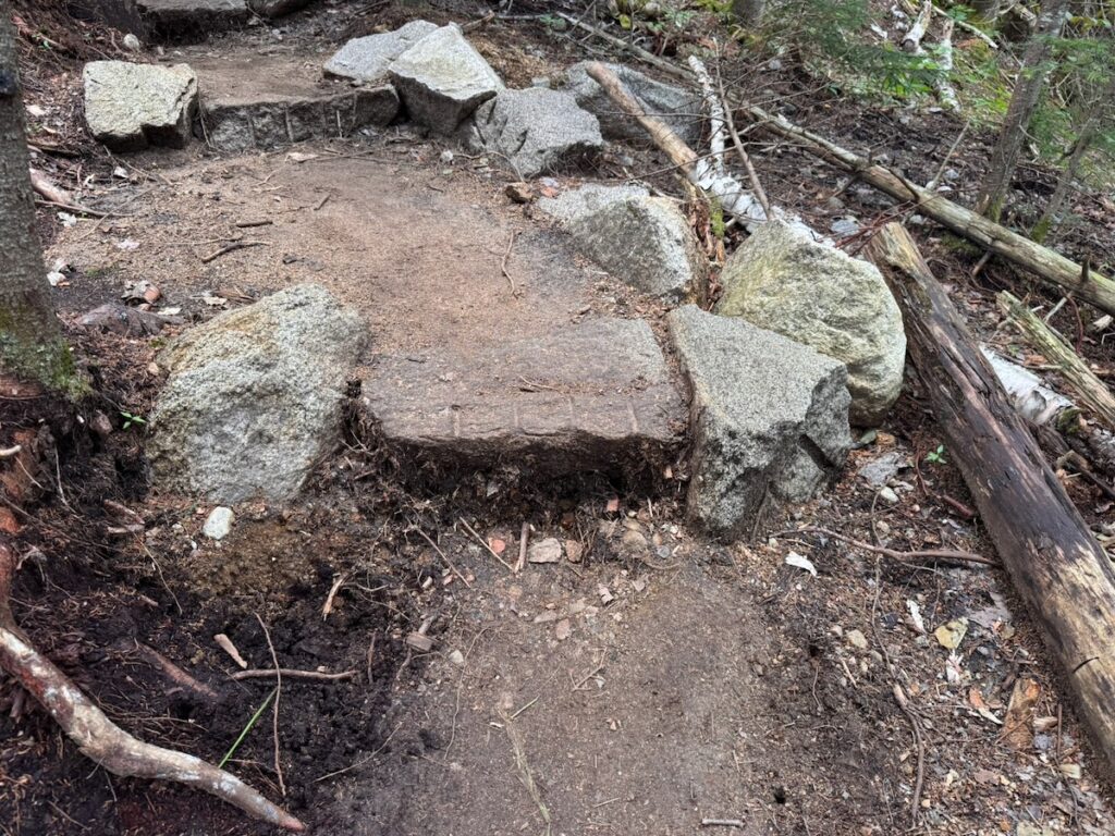
As discussed in the previous article, a properly placed foundation stone at the base of a stair cluster protects the staircase from being undermined as water and foot traffic remove soil below it.

For some crews, this represented a different approach from their previous stonework practices. It also requires another substantial piece of stone and additional labor. Under the pressure of time and budgets, that additional work can seem expendable.

It isn’t.

Where a staircase is undermined from below, the effective height of the bottom step increases and the stability of the staircase above can eventually be compromised.

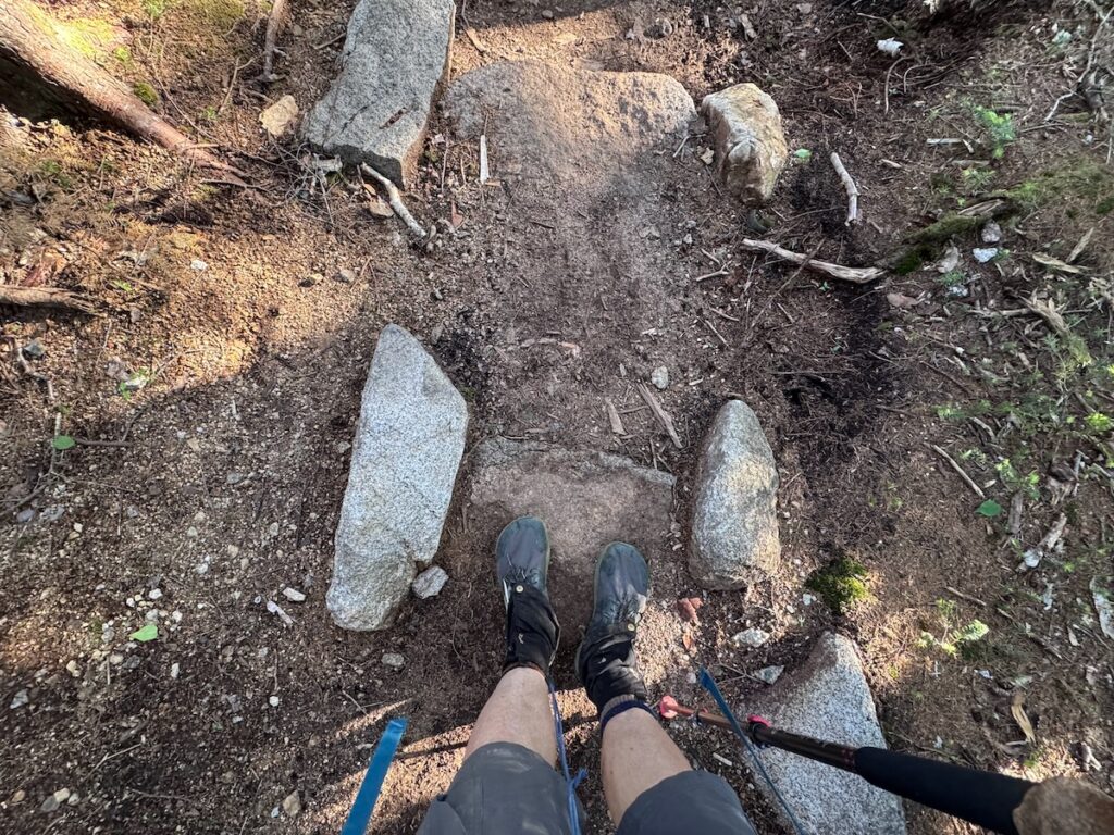
We are also discovering something we did not fully anticipate. In some locations, foundation stones that were originally flush with the tread, or even slightly buried, are now protruding two to four inches after only a few years as surrounding tread material erodes.

If that continues, a foundation stone intended to protect a staircase can eventually become a step itself, but a step with no foundation stone beneath it.

That tells us something important. Even some of our improved construction techniques need to be monitored over time and modified in response to what actually happens on a trail receiving this intensity of use.

Waterbars Versus Reverse Grade Drainage

We also did not consistently make the transition from traditional waterbars to drainage created through trail alignment and grade reversals.

Some newly reconstructed sections still rely on waterbars. Several are already beginning to collect sediment and debris.

The problem is not that waterbars never work. They do. The problem is that their effectiveness depends upon maintenance.

And this exposes a larger contradiction in White Mountain trail management: we continue to build drainage structures that depend upon a level of routine maintenance we often do not have the capacity to provide.

Where terrain allows, reverse grades and appropriately shaped tread offer a fundamentally different approach. Instead of asking someone to repeatedly restore the drainage, we build drainage into the geometry of the trail itself.

That distinction becomes increasingly important as rainfall becomes more intense and maintenance needs increase.

What Lies Beneath the Tread

Perhaps the issue that concerns me most as the federally funded phase of the project concludes is tread preparation.

In some sections we underestimated the depth of the organic soil beneath the existing trail.

On a lightly used trail, it may sometimes be possible to allow a new tread to evolve gradually. Organic material compacts or erodes, rocks and roots emerge, and crews return periodically to improve the surface as the trail hardens.

Franconia Ridge doesn’t provide that luxury.

Thousands of hikers can pass over a newly reconstructed section in a matter of weeks. If unsuitable organic material remains beneath the tread, deterioration that might take years elsewhere can happen in months.

During these final weeks of the project, there is understandable pressure to finish as much trail as possible. In some places, that has meant leaving more organic material in the tread than I believe is desirable.

With careful monitoring and rapid intervention as problems emerge, it may be possible to progressively harden these sections. But that requires professional trail crews to return when problems first appear, rather than years later after deterioration has become severe.

In that sense, we are conducting an unplanned experiment in adaptive trail management.

The experiment may work.

But only if somebody is there to observe the results and has the resources to respond.

And What About All Those Steps?

There is an even larger design question worth asking.

As I described in the previous article, one of our White Mountain compromises has been to alternate lower-grade side-hill trail with relatively short clusters of stone steps. This allows us to gain elevation within constrained terrain while avoiding a continuously steep trail.

I continue to believe this can be an effective approach.

But a trail designer looking at the Franconia Ridge project from outside the White Mountains might reasonably ask:

Are we still building too many steps?

Stone staircases are expensive to construct. Hikers sometimes bypass them. They concentrate elevation gain into short distances. And unless drainage is carefully incorporated into their design, water can accelerate down them and erode the tread below.

The question should not be whether steps are good or bad. It should be whether we have found the right balance between steps, climbing turns, longer contour alignments, grade reversals and other ways of gaining elevation.

Above Treeline Is a Different Trail Problem

There was another fundamental issue that the original project planning did not adequately address: the Franconia Ridge Loop is not one trail environment.

Much of what we have discussed so far applies primarily to trails below treeline. There we can realign trails across forested slopes, excavate full-bench tread, mine mineral soil, build cribbing, construct grade reversals and, where appropriate, move the trail substantially away from its historic alignment.

Above treeline, we enter a fundamentally different ecological and management context.

On the Franconia Ridge Trail between Mount Lafayette and Little Haystack, the trail passes directly through a small and exceptionally vulnerable alpine ecosystem. Soil is thin, vegetation grows slowly, opportunities for realignment are limited, and even relatively small amounts of trampling can expand the disturbed corridor.

At the same time, this is where visitor behavior becomes particularly important.

Traditional scree walls have long been used to define the trail corridor above treeline, but at Franconia Ridge levels of use they are often inadequate by themselves. People step over them, walk around other hikers, leave the tread at viewpoints, and create parallel paths around high steps and other pinch points.

The appropriate response therefore cannot simply be more stonework.

Alpine trail management needs to combine physical trail design with active management of visitor movement. That can include appropriately wide and clearly defined tread, elimination or reconstruction of high steps and pinch points, strategically located pull-outs and passing areas, cairns and other route-definition techniques, temporary string fencing, interpretive signage, restoration of unnecessary parallel tread, and the visible presence of Summit Stewards who can both educate visitors and respond to emerging problems.

In other words, above treeline the distinction between trail construction and trail stewardship begins to disappear.

A trail crew can rebuild a section of tread. But whether hikers remain on that tread depends upon its width, the height and placement of its steps, where people naturally stop and pass, how clearly the route is defined, what visitors understand about the vegetation around them, and whether somebody is present to observe how the system is actually functioning.

The congressionally funded project never substantially reached the Franconia Ridge Trail beyond Mount Lafayette.

In retrospect, that may have been fortunate.

Simply extending the below-treeline construction model across the ridge would not have been enough. The alpine section requires its own assessment, design standards, visitor-flow analysis and management plan before major reconstruction begins.

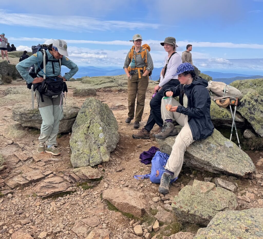
WTN Americas Summit Stewards have already undertaken substantial trail tending and restoration work on Franconia Ridge, giving us an opportunity to experiment with some of these approaches on the ground. Building on that experience, the Alpine Stewardship Center has proposed a new model of integrated alpine trail management in which Summit Stewards are trained not only in visitor education and ecological stewardship, but also in increasingly advanced trail work. Stewardship, monitoring, trail reconstruction and adaptive management become parts of the same job rather than separate activities carried out by different programs.

That may point toward something larger than a solution for Franconia Ridge.

It may provide a model for how we manage heavily visited alpine trails throughout the White Mountains.

WTN Americas Summit Stewards on the summit of Mount Lafayette.

The Larger Lesson

None of these shortcomings negate the accomplishments of the Partnership to Restore the Franconia Ridge Loop.

Quite the opposite. We now know much more than we did five years ago.

But perhaps the most important lesson is that the next project of this scale should begin differently.

Before announcing that we will rebuild a trail from start to finish, we should conduct a detailed trail log and condition assessment. We should document visitor volumes and behavior. We should identify the different ecological and management environments through which the trail passes rather than assume that one design approach applies everywhere. We should divide the trail into management and construction units, identify the appropriate treatment for each, establish construction standards, estimate costs from those designs, and then determine the funding and timeframe required.

And the standards group should not disappear once construction begins.

It should become a standing design and technical review team that walks completed work, compares approaches among crews, monitors failures and successes, and updates standards throughout the life of the project.

Most importantly, we should stop thinking of a major trail restoration as something that is finished when the construction grant ends.

A trail carrying 45,000–50,000 visitors through steep mountain terrain, including an extraordinarily sensitive alpine ecosystem, requires continuing professional attention: monitoring, maintenance, reconstruction, ecological stewardship, visitor management and adaptation.

And that brings us to a conclusion I did not fully appreciate when the Franconia Ridge project began five years ago.

The challenge facing Franconia Ridge is not simply that we have deteriorated trails that need to be rebuilt.

We have a trail management system that needs to be rebuilt as well.

For much of the last century, the White Mountains have depended upon an extraordinary patchwork of federal and state agencies, nonprofit organizations, professional trail crews, seasonal programs, trail adopters and volunteers. That system has accomplished remarkable things. But it was largely created for another era of recreational use, another level of funding, and another climate.

Franconia Ridge is showing us the limits of that system.

It is also showing us pieces of what might replace it: trails designed for actual visitor volumes; professional construction integrated with volunteer work; permanent technical review and monitoring; Summit Stewards who combine visitor management with trail tending; and adaptive management that responds to what happens on the ground rather than waiting decades for the next major reconstruction project.

That is a much larger subject than the Franconia Ridge Loop Restoration.

Next in this series: The White Mountains Trail Management Crisis, and What Comes Next.

What We Did Right in the Franconia Ridge Loop Restoration

This is the second in a four-part series reflecting on the accomplishments of the Franconia Ridge Loop Restoration, what we could have done better, and where we go from here.

  1. Five Years of the Partnership to Restore Franconia Ridge
  2. What We Did Right in the Franconia Ridge Loop Restoration
  3. What We Could Have Done Better: Lessons from the Franconia Ridge Loop Restoration
  4. How We Got Here: The Historical Roots of the White Mountains Trails Crisis?
  5. Rethinking the White Mountain Trail Management System (to come)

The Partnership to Restore the Franconia Ridge Loop did more than rebuild deteriorated sections of trail. At its best, it demonstrated a different approach to designing and constructing trails for the conditions we now face in the White Mountains.

Many of our steep legacy trails were laid out more than a century ago, when use was dramatically lower and our understanding of sustainable trail design was very different. Today, the Franconia Ridge Loop receives 45,000–50,000 visitors between May and October, while increasingly intense rain events put additional stress on trails already carrying extraordinary levels of foot traffic.

Repairing these trails in place is no longer enough. Many White Mountain trails need to be fundamentally redesigned to reflect the realities of terrain, geology, ecology, and steadily increasing visitation. At the same time, trail design must recognize the diverse ways people move through the landscape today, whether hiking, trail running, mountain biking, or using mobility devices such as wheel chairs. Sustainable trails must be resilient not only to natural forces, but also to the evolving ways people experience the outdoors.

Here are some of the things I believe the Franconia Ridge Loop project got right.

Trail Realignment

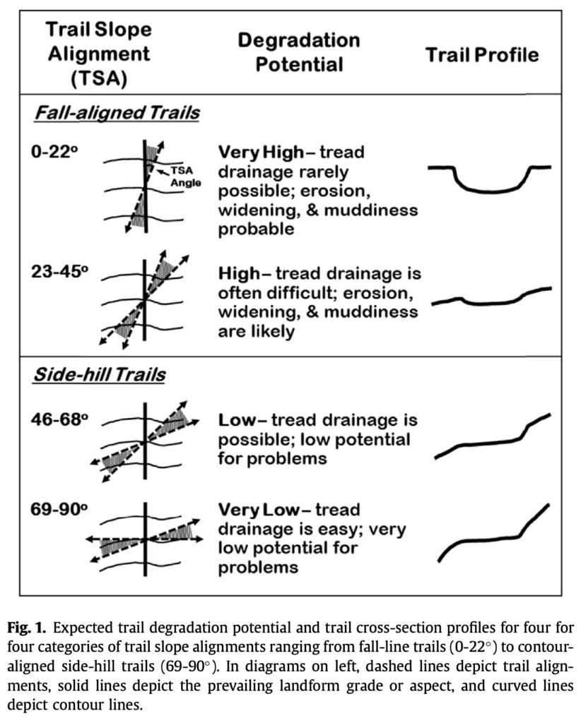
Many of the White Mountains’ steep legacy trails follow, or come close to following, the fall line, the direction of steepest descent down a slope. Unfortunately, that is also the direction water wants to travel.

At relatively low levels of use, these trails can persist for a very long time. As I discussed in my essay Trails and Time, however, at moderate and especially high levels of use, the combination of water and thousands of boots accelerates erosion. The result is familiar throughout the White Mountains: trails that gradually become deeply eroded channels filled with exposed rocks and roots, with sediment carried downslope toward streams and rivers.

The most important solution is often not to keep repairing the old trail, but to change its alignment.

By moving a trail onto the side slope and allowing it to climb more gradually across the contour, we can dramatically reduce the distance that water travels down the tread and create opportunities for water to leave the trail naturally. A properly designed side-hill trail is consequently less susceptible to erosion and requires less intensive maintenance.

That sounds simple. In practice, on the steep, rocky terrain of Franconia Notch, it is anything but.

Reverse-Grade Drainage

Realignment by itself does not solve the drainage problem. Even a side-hill trail has a grade, and water will follow that grade downhill unless we give it somewhere to go.

Traditionally, White Mountain trails have relied heavily on waterbars: stone or wooden structures placed across the trail to intercept water and divert it from the tread. Properly constructed and maintained, they can work. The problem is that waterbars collect sediment and debris and therefore require frequent cleaning.

grade reversal | Kansas Trails CouncilKansas Trails Council

That creates an enormous maintenance burden. A steep legacy trail can require scores or even hundreds of drainage structures, some needing attention multiple times during a season. With increasingly intense rain events, keeping every drainage structure functioning becomes extraordinarily difficult. We should not blame trail adopters and trail crews when that system begins to fail. We should ask whether we can design trails that require less intervention in the first place.

One of the most important techniques used in the Franconia Ridge project is therefore reverse-grade drainage.

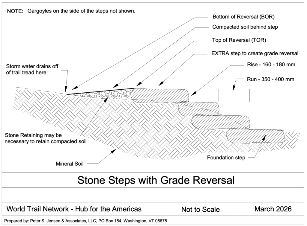
Instead of continuously climbing, the trail briefly levels and descends before beginning to climb again. This creates a natural low point where water can leave the trail. Combined with an appropriately outsloped tread, water drains from the trail largely through its shape, rather than depending upon a structure that must continually be cleaned.

The best drainage structure, in other words, can be the trail itself.

Using Steps Without Building a Staircase Up the Mountain

There is a complication.

An ideal side-hill trail with frequent grade reversals can require a great deal of horizontal distance to gain elevation. In the convoluted, rocky terrain of the White Mountains, we simply do not always have that space.

Many modern professional trail builders therefore regard stone steps as something to use judiciously rather than as the first solution to a steep slope. But avoiding steps entirely can require very long realignments, while simply building a staircase straight uphill recreates many of the drainage problems we are trying to solve.

The Franconia Ridge project has demonstrated an important compromise.

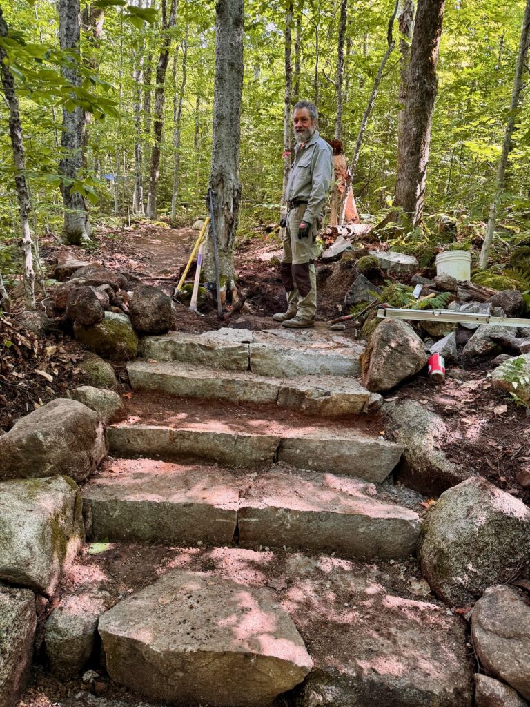
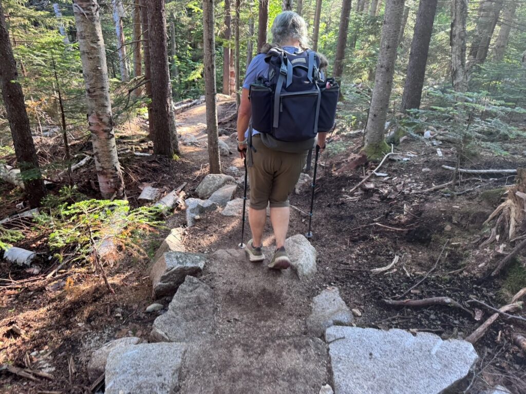
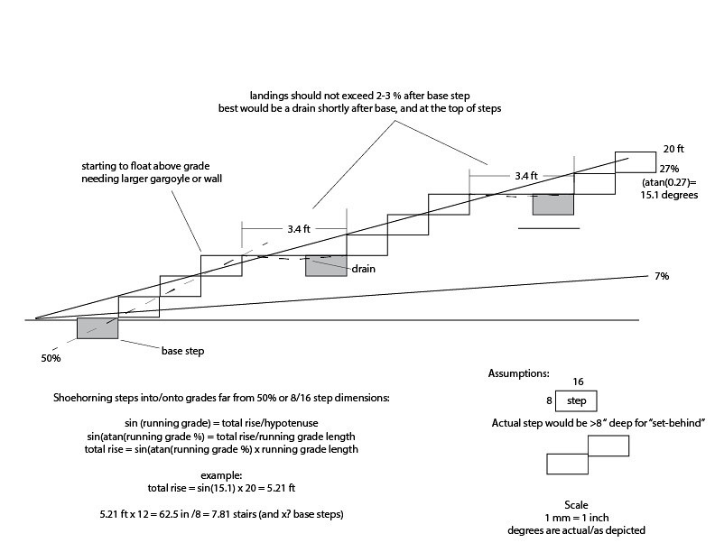
Rather than constructing long, continuously steep staircases, we can use small clusters of stone steps to gain elevation relatively quickly, followed by longer sections of trail at a much lower grade, often around 10–12 percentwhere the terrain permits. A reverse grade can be incorporated at the top of a step cluster before the trail resumes climbing.

These combinations can often be incorporated into a climbing turn, allowing the trail to gain substantial elevation while maintaining sustainable grades and drainage over most of its length.

Professional trail builder Peter Jensen has refined this approach over many years, and it has been used extensively in the Franconia Ridge Loop restoration.

The result is not a trail without steps. It is a trail in which steps, grade and drainage work together.

Steps Designed for Human Beings

Stone steps have been part of the White Mountain trail-building toolbox for decades. What has not always received enough attention is their rise and run: how high hikers must step and how much usable surface each step provides.

The White Mountains are famous for what are sometimes called “power steps” or “Paul Bunyan steps.” I confess that as a young trail builder, I helped build them. There was almost an assumption that hikers should have to make an extra effort to get up the mountain.

But hikers and trail runners respond to the trail in front of them. Faced with an awkwardly high step and an easier route around it, many people will unconsciously choose the easier route. Multiply that decision by tens of thousands of hikers and the result is widening, braiding and erosion alongside the constructed trail.

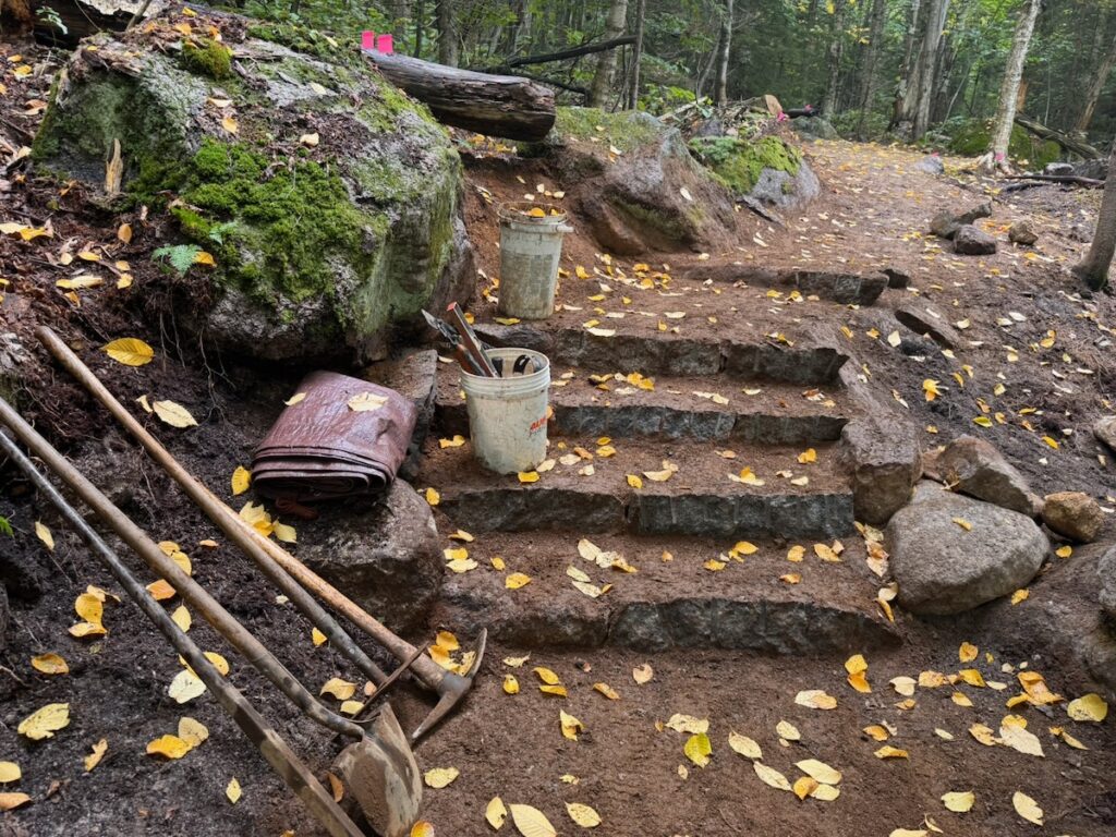
On the Franconia Ridge project, we have increasingly aimed for stone steps with a comfortable rise of no more than about 7–8 inches and, where the available stone allows, a run of roughly 14–16 inches.

That isn’t merely about making hiking easier.

A trail people naturally want to walk on is also a trail they are more likely to stay on.

Foundation Steps

Good stone stair construction begins at the bottom.

A secure foundation step at the foot of a stair cluster is essential. Without it, erosion can undermine the bottom of the staircase and destabilize everything above it.

This matters particularly because steep trail sections concentrate and accelerate water. The principle is straightforward: the steeper the grade, the faster water can flow; the faster it flows, the greater its erosive power.

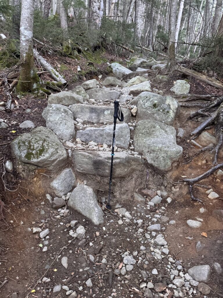
We can see the consequences on older sections of both the Old Bridle Path and Falling Waters Trail. Some stone steps have been undercut by more than a foot. That represents an extraordinary amount of lost soil, but it also changes the effective height of the step. A once-manageable stone step gradually becomes another “Paul Bunyan step,” encouraging hikers to find a route around it.

A well-founded staircase, combined with drainage that keeps water from accelerating through it, is therefore fundamental to durable stonework.

Full-Bench Construction, Cribbing and Tread Preparation

A sustainable side-hill trail also requires a proper bench cut.

Rather than placing tread material on the surface of a slope, the trail is cut into the hillside to create a stable walking surface. Wherever terrain permits, a full-bench trail, with the entire tread excavated into undisturbed mineral soil, provides the strongest foundation.

On a lightly used trail, a relatively modest tread may gradually become established through use. That is not adequate for a trail carrying tens of thousands of hikers each year.

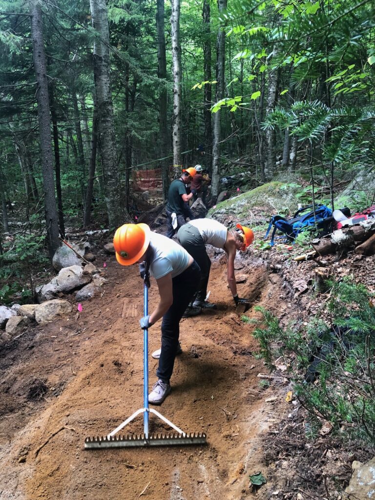
The organic surface layer must be removed and the tread prepared with suitable mineral soil and crushed aggregate where necessary. On our Old Bridle Path work, we sometimes literally mine the material, digging small pits nearby to find appropriate mineral soil and aggregate.

Skipping this step may produce a trail that looks finished when the crew leaves, but heavy traffic will quickly compact and displace organic material, exposing roots and rocks. Placing heavier mineral material directly over an unsuitable organic layer doesn’t solve the problem either. The underlying organic material eventually mixes upward into the tread, creating a soft, muddy and unstable surface.

Where the hillside is too steep to support the desired tread width through benching alone, stone cribbing can retain the outside edge, allowing the space behind it to be filled with suitable mineral material and creating a durable, stable tread.

Much of the quality of a trail, in other words, lies beneath hikers’ feet where they will never see it.

A Trail Width That Reflects Actual Use

One of the most visible changes on reconstructed sections of the Franconia Ridge Loop is that the trail is sometimes wider than the trail it replaced.

At first, that can seem counterintuitive. Isn’t the goal to make the trail’s footprint as narrow as possible?

Not necessarily.

On a trail carrying 45,000–50,000 visitors a year, people regularly meet and pass one another. If the constructed tread is too narrow for that behavior, hikers step onto its edges and into adjacent vegetation. The effective trail becomes wider regardless of what width appears on the construction plan.

Forest Service trail standards allow considerable variation in tread width depending upon trail class, designed use, terrain and management objectives. On portions of the Franconia Ridge Loop, we have used tread widths of up to approximately 60 inches, particularly where accommodating two-way traffic helps keep hikers on the constructed surface.

That leads to an important principle for heavily traveled trails:

Sometimes a somewhat wider constructed trail creates a smaller overall area of disturbance.

The trail should be designed not simply for an abstract standard, but for the way tens of thousands of people actually use it.

Toward a New White Mountains Standard

These are not all of the sustainable design and construction techniques used in the Partnership to Restore the Franconia Ridge Loop. But together they represent something larger than a collection of trail-building details.

They represent a change in philosophy.

Rather than repeatedly repairing a century-old trail in place, we can design the trail around water. We can use alignment and grade to shed water before it gains erosive force. We can use stone steps strategically rather than simply building straight uphill. We can construct steps that people naturally want to use. We can build a durable foundation beneath the tread. And we can make the trail wide enough to accommodate the number of people who actually hike it.

Perhaps most importantly, the project has demonstrated that heavily used White Mountain trails require a different standard of design and construction than trails receiving a few thousand visitors a year.

The Partnership to Restore the Franconia Ridge Loop has made an enormous contribution toward establishing that standard.

But if this is the standard we now know how to build, another question follows:

Did we apply it consistently across the Franconia Ridge Loop, and what have we learned about how to do better?

That will be the subject of the third and final article in this series: What We Could Have Done Better in the Franconia Ridge Loop Project.

5 Years of the Partnership to Restore Franconia Ridge 

This is the third in a five-part series reflecting on the accomplishments of the Franconia Ridge Loop Restoration, what we could have done better, and where we go from here.

  1. Five Years of the Partnership to Restore Franconia Ridge
  2. What We Did Right in the Franconia Ridge Loop Restoration
  3. What We Could Have Done Better: Lessons from the Franconia Ridge Loop Restoration
  4. How We Got Here: The Historical Roots of the White Mountains Trails Crisis?
  5. Rethinking the White Mountain Trail Management System (to come)
Sept. 1, 2026. Franconia Notch State Park, New Hampshire — Celebratory event to mark 5 years of the Franconia Ridge Restoration Project. AMC staff and project partners with US Senator Jeanne Shaheen. Photo by Amanda Maria Garza.

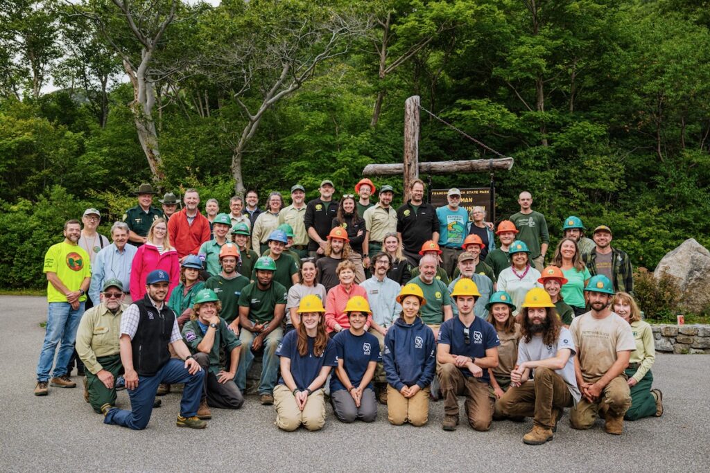
On Tuesday, September 1, groups gathered in Franconia Notch to celebrate five years of the Partnership to Restore Franconia Ridge, marking the conclusion of trail work supported by Congressionally Directed Funding secured by U.S. Senator Jeanne Shaheen and led by the Appalachian Mountain Club (AMC).

Senator Shaheen joined White Mountain National Forest Supervisor Derek Ibarguen and AMC President and CEO Nicole Zussman, along with leadership and staff from the US Forest Service and AMC. Also attending were members of several of the crews that have worked on the Franconia Ridge Loop over the past five years, including the NorthWoods Stewardship Center, Student Conservation Association, Vermont Youth Conservation Corps, and AMC volunteer and professional trail crews.

Representatives of WTN Americas/Pan American Trails were also invited and attended. Although our work was not supported by the Congressionally Directed Funding, it has become an important part of the larger effort to restore the Loop.

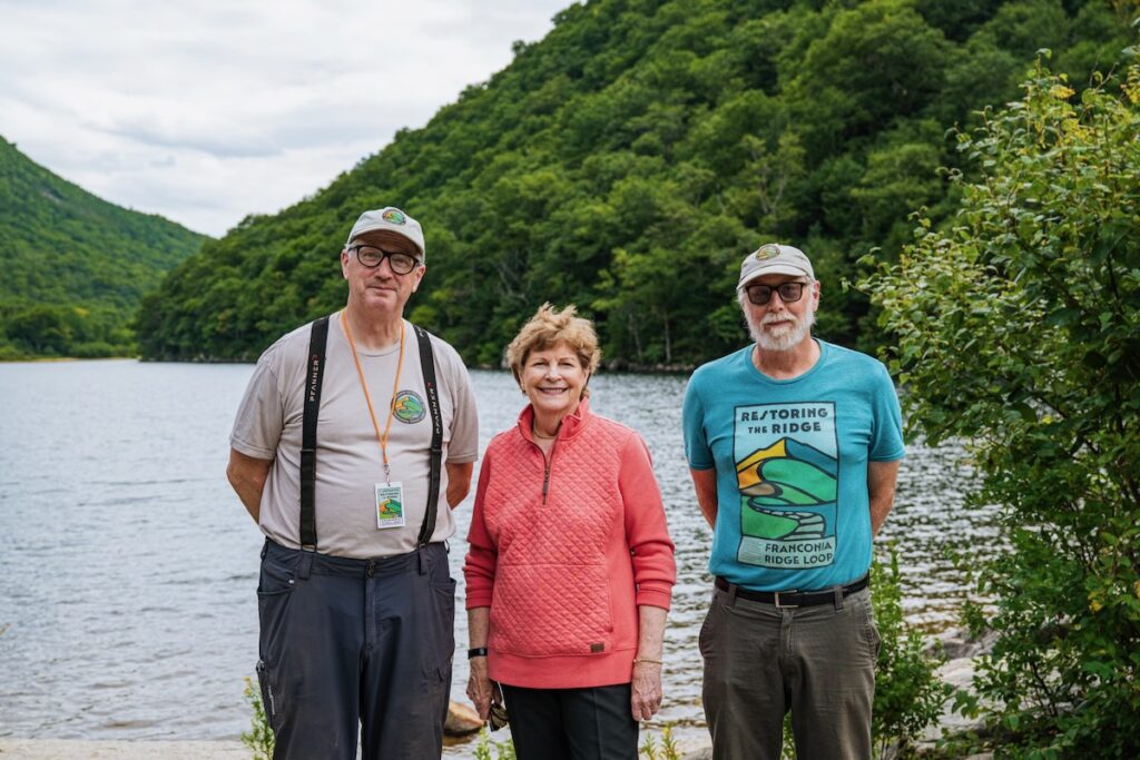
Sept. 1, 2026. Robert White, Jeanne Shaheen, and Nat Scrimshaw. Photo by Amanda Maria Garza.

The congressional funding did not cover the portions of the Old Bridle Path and Falling Waters Trail located on Franconia Notch State Park lands. WTN Americas/Pan American Trails secured private funding to extend the restoration effort into these sections. Our professional crews, Peter S. Jensen & Associates LLC and the Trail Fixing Collective LLC, have worked extensively on the Old Bridle Path and continue that work today. This year, private support is being supplemented by a New Hampshire Recreational Trails Program grant.

Altogether, WTN Americas/Pan American Trails has brought over $600,000 in additional funding to the Franconia Ridge Loop effort, representing more than one-third of the investment in the entire project. And our work will continue beyond the conclusion of the congressionally funded project. In 2027, we plan to move restoration work to the Franconia Notch State Park section of Falling Waters Trail.

The Work Still Ahead

As we celebrate what has been accomplished, this five-year milestone also provides an opportunity to take stock.

The original vision was ambitious: to “redesign the Franconia Ridge Loop from start to finish.” Five years later, despite an extraordinary investment of money, labor, expertise, and volunteer effort, that work is not complete.

Substantial work remains even on the two approach trails, Old Bridle Path and Falling Waters Trail. Only a relatively small amount of work has been completed on the upper Greenleaf Trail in the alpine zone. And no congressionally funded restoration work was undertaken on perhaps the most ecologically sensitive section of the entire Loop: the Franconia Ridge Trail between Mount Lafayette and Little Haystack.

WTN Americas/Pan American Trails Summit Stewards have undertaken substantial trail tending and restoration work along this alpine section, but without support from the Congressionally Directed Funding and therefore outside the formal restoration project.

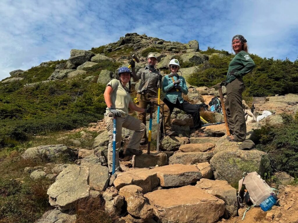
2026. WTN Americas/Pan American Trails Summit Stewards resetting steps on the Franconia Ridge Trail.

In other words, after five years and a tremendous investment, we have learned something important about the scale of the challenge:

If our goal is to truly restore and sustainably manage the Franconia Ridge Loop, the work has only begun.

That does not diminish what this partnership has accomplished. Quite the opposite.

The project represents a major advance in promoting a new standard for trail design and construction in the White Mountains. It has demonstrated what becomes possible when significant resources, skilled professional crews, public agencies, nonprofit organizations, and volunteers are brought together around a shared project.

It has also given us lessons that should inform how projects are planned and designed; how priorities are established across an entire trail system; how professional and volunteer crews can best complement one another; and how trail reconstruction can be integrated with the ongoing stewardship required after the construction crews leave.

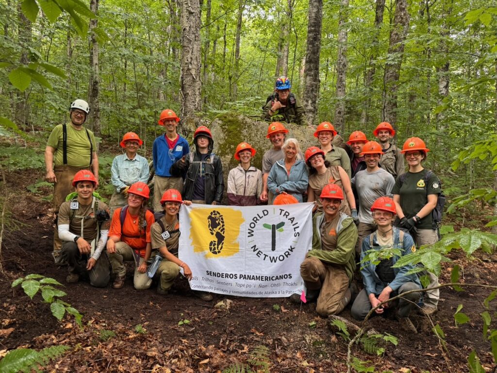
2026. Volunteers working on the the Franconia Notch State Park section of the Old Bridle Path.

Our Old Bridle Path volunteer workdays, organized in partnership with AMC, offer one example. In my experience, they represent one of the most effective integrations of volunteer labor into a professional trail construction project I have seen. Volunteers are not simply doing work adjacent to the professional project. Their work is planned so that it directly advances and complements what the professional crews are building.

However, the work does not end when a grant ends. Nor does rebuilding the physical trail, by itself, solve the challenges facing Franconia Ridge. Summit stewardship, routine trail tending, ecological restoration, visitor management, monitoring, and continued reconstruction all have to become parts of a sustained effort.

So, as this five-year chapter comes to a close, where do we go from here?

Next week we will, we will consider: Franconia Ridge Loop restoration beyond 2026.